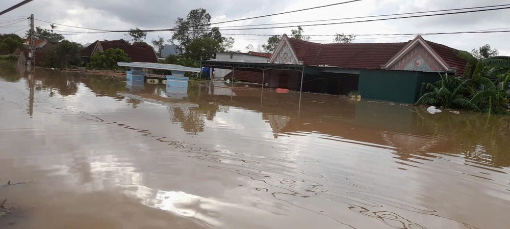
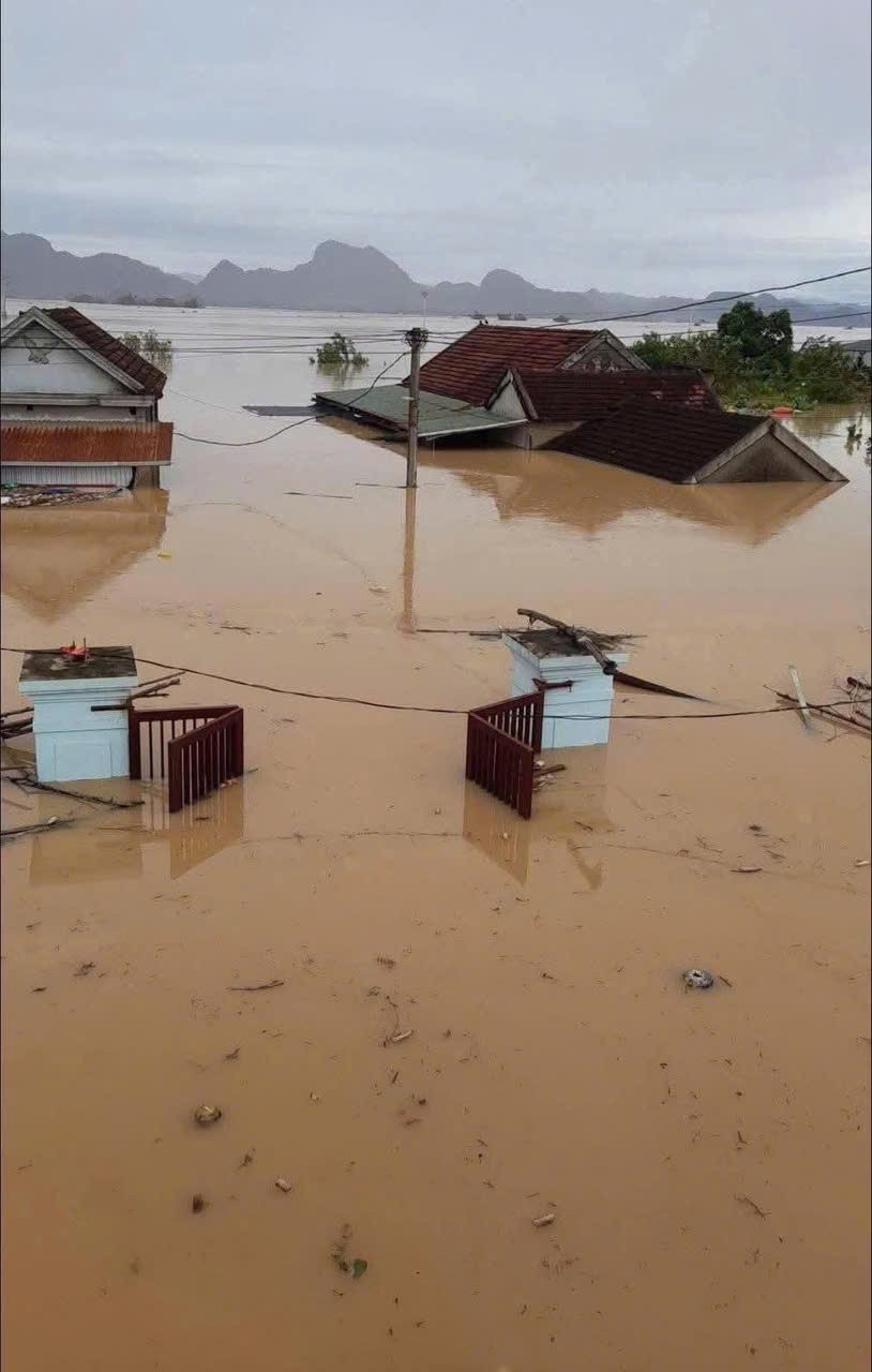
Mr. Nguyen Xuan Nam, Chairman of Nghia Hanh Commune, reported on the morning of October 1 that while the rain had ceased locally, the Lam and Con rivers continued to swell, engulfing all 21 hamlets of the commune.
According to the commune’s report, heavy downpours began late on September 28. By 3 a.m. on September 30, floodwaters from upstream surged into the area, rising rapidly. By the evening of the same day, all 21 hamlets were under water, 17 of them deeply submerged.
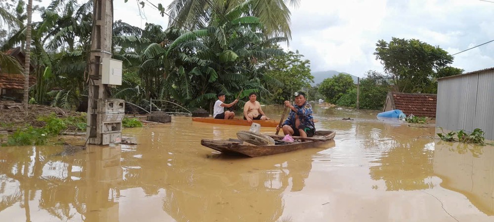
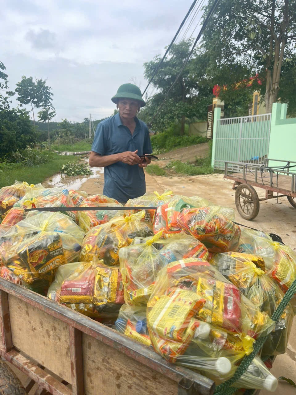
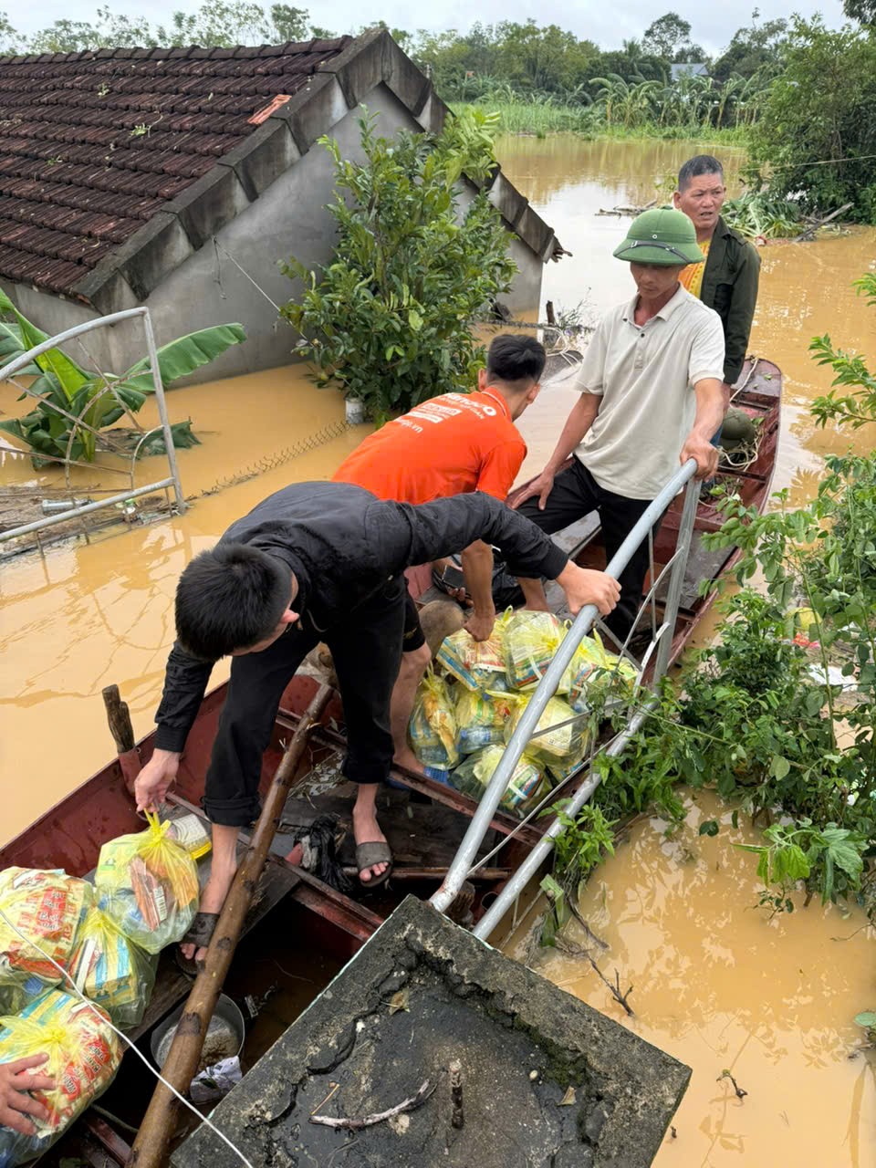
Throughout the night, local authorities mobilized all available manpower and small boats to evacuate residents, but limited rescue equipment made operations extremely challenging.
 are submerged and cut off.")
“This is an unprecedented, historic flood for our commune,” Nghia Hanh Commune Chairman said, adding that river levels reached depths of 8–9 meters in some areas, submerging nearly every road. Even the Ho Chi Minh Trail—the only accessible route—was partly submerged by the evening of September 30. Many families who had sought higher ground found themselves stranded, surrounded by floodwaters, without food or drinking water.
In Tan Phu Commune, located along the Con River, eight hamlets were inundated. “During the night of September 30, we evacuated 200 residents to safety. By the morning of October 1, floodwaters began to recede slightly, but many areas remain under deep water,” said Mr. Vi Van Quang, Chairman of the People’s Committee of Tan Phu Commune. He noted that rescue efforts are hampered by a severe shortage of equipment.
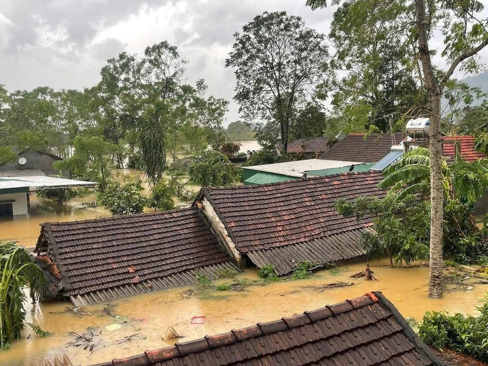
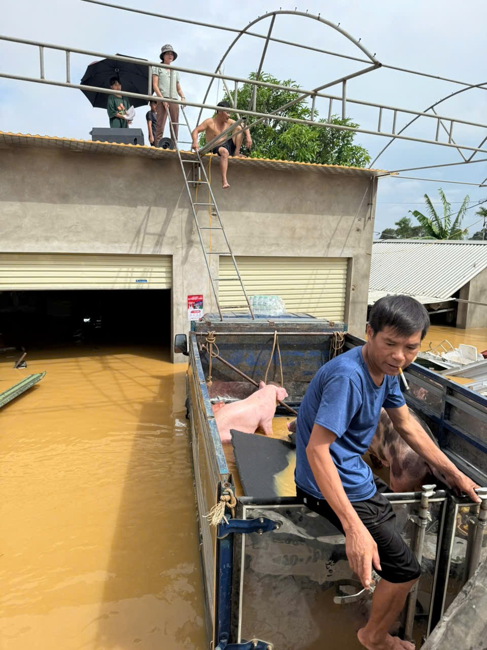
Rising waters of the Con River have also submerged nearly 600 homes in Tan Ky Commune. Many households were unable to move their belongings in time, suffering heavy losses. Overnight, local authorities conducted emergency evacuations, prioritizing the elderly, children, and women, to bring them out of danger zones.

Meanwhile, in Yen Hoa Commune, Chairman Dau Duc Truyen reported that floods swept away the Trung Thang concrete bridge over the Huoi Nguyen stream, cutting off access to three villages and isolating more than 3,000 residents. Another bridge—Xop Chang, on National Highway 48C—was also washed away, severing transport between Yen Hoa and Nga My communes. Preliminary reports indicate seven houses collapsed, multiple landslides occurred, and several villages and schools remain isolated.


)