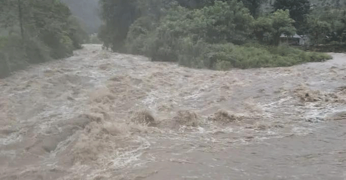
Prolonged heavy rainfall, coupled with upstream floodwaters, has caused river levels along the Thu Bon and Vu Gia rivers to rise sharply, inundating low-lying downstream areas, including Que Phuoc, Thuong Duc, Vu Gia, and Dai Loc in Da Nang City, while cutting off key transportation routes.
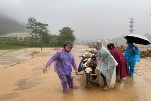
In Dai Loc Commune, floodwaters began rising rapidly around 7 a.m. on November 17. By noon, some local roads were submerged under 0.3–0.5 meters of water, resulting in partial traffic paralysis. Anticipating severe flooding similar to previous events, many residents moved their vehicles to higher ground near Ai Nghia Bridge. Le Quang Trung from Nghia Phuoc Hamlet said, “After hearing the flood alert last night, my family relocated all our belongings to higher ground. The water has risen steadily since morning, but more slowly than in previous floods. This is the fifth flood in just one month.”
In Que Phuoc Commune, persistent rain and upstream runoff have cut off multiple roads since the afternoon of November 16. National Highway 14H experienced numerous flooded sections, notably near Khe Rinh Bridge. Phoc Bridge is submerged under nearly one meter of fast-flowing water, preventing vehicle passage, while Quan Bridge in Ninh Khanh Hamlet is under more than one meter of water over a stretch of nearly 100 meters and has been blocked at both ends. Other areas, including Da Bridge toward Bau Sam, have also seen strong water overflow. Roads from Dong An to Tu Trung are completely impassable, and residents in some neighborhoods with water levels exceeding one meter have relied on boats to move.

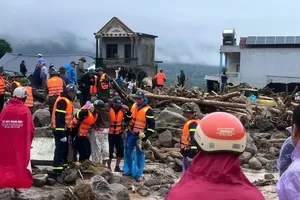
Ms. Tao Thi To Diem, Chairwoman of the People’s Committee of Que Phuoc Commune, said local militias, police, and rapid-response teams are stationed 24/7 at critical points to guide residents, erect barriers, and temporarily suspend traffic in deep-water areas. Authorities are also reviewing low-lying zones, riverside areas, and locations prone to flash floods or landslides to prepare for evacuations. In Xuan Hoa Hamlet, 17 households with 35 residents were evacuated on the afternoon of November 16 due to landslide risk.
In Nong Son Commune, the road from Que Loc to Trung Phuoc has multiple flooded sections, some exceeding one meter, cutting off inter-hamlet connections. Local authorities have set up checkpoints to prevent travel and ensure safety.
According to the Central Regional Center for Hydrology and Meteorology, river levels in Da Nang are rising rapidly. As of reporting, Vu Gia River at Hoi Khanh is 0.18 meters below alarm level 3, at Ai Nghia 0.05 meters below alarm level 3; Thu Bon River at Nong Son is 0.73 meters above alarm level 2, at Giao Thuy 0.46 meters above alarm level 1, at Cau Lau 0.17 meters below alarm level 2, and at Hoi An 0.22 meters below alarm level 2. Water levels are forecast to rise further in the next 12 hours, with Vu Gia exceeding alarm level 3 and Thu Bon surpassing alarm level 2. Tam Ky and Han rivers are expected to reach alarm levels 1–2.