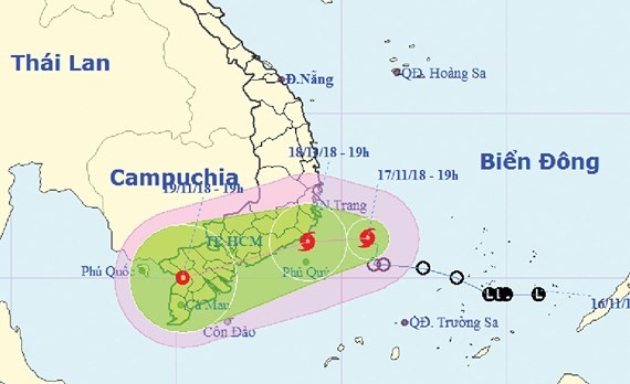
In next 24 hours, typhoon Toraji is predicted to move the westward with its speed up 10 kilometers per hour.
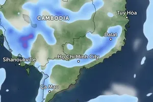
By 7pm Sunday, its eye is expected to locate at 11.1 degrees north latitude and 109 degrees east longitude in the territorial waters of Ninh Thuan and Binh Thuan provinces.
Due to an impact of the storm, the mid and south- East Sea have experienced threats of gusty rains, sea rough, powerful wind of level 6-1o and big waves of 3-5 meters.
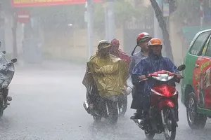
The weather condition will result in outbreaks of medium- heavy rains and strong wind in areas of Ninh Thuan, Binh Thuan and Ba Ria- Vung Tau provinces.
Within next 24-48 hours, Toraji will move west- southwestwards at around 15 kilometers an hour before it will turn into a tropical low pressure system.
By 7pm Monday, Toraji will approach the mainland of the southern provinces with its maximum wind near the center at 40- 50 kilometers an hour.
Because of its influence, the south- Central, Central Highlands and Southern regions have faced medium- heavy rains with the highest rainfall of 70- 150 mm from November 17- 19.
A flooding is warned to hit local rivers across the south- Central region. Additionally, threats of landslide and flash flood are predicted to appear in low-lying areas and coastal cities.
Earlier, the tropical low depression formed from a low- pressure zone hit the south parts of the East Sea.
At 7pm yesterday, it was centered at 11.2 degrees north latitude and 110.8 degrees east longitude, at around 220 kilometers of the eastward of the territorial waters from Ninh Thuan to Binh Thuan with a gusty wind of 60-75 kilometers an hour near the center.
At 7pm yesterday, it was centered at 11.2 degrees north latitude and 110.8 degrees east longitude, at around 220 kilometers of the eastward of the territorial waters from Ninh Thuan to Binh Thuan with a gusty wind of 60-75 kilometers an hour near the center.
Dealing with the bad weather, the National Committee for Natural Disasters Prevention sent an emergency telegraph to request 55 provinces and cities from Binh Dinh and Kien Giang and relevant agencies as the Ministry of National Defense, the Ministry of Transportation, the Ministry of Foreign Affairs, the Ministry of Natural Resources and Environment, the Ministry of Information and Communications, the Ministry of Agriculture and Rural Development.. to deploy anti- natural disaster measures through keeping eyes current complicated weather condition of downpours, high tides, flooding, thunderstorms and cyclones in order to ensure property and people safety, instructing vessels out of the dangerous area, controlling means of transportation offshore…
Toraji is the eight typhoon hitting the East Sea this year.



)


