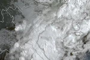
The National Center for Hydro Meteorological Forecasting (NCHMF) said this afternoon August 14, the strongest winds near its center will reach at level 8-9.
Due to the impact of the typhoon, the northern part of the East Sea will see strong winds; the areas in the north and nothern part of the East Sea will have heavy rains.
In the next 24 to 48 hours, Bebinca will move west and west north with wind speeds ranging 5 to 10km per hour. On August 15, it will center on Loizhau peninsula (China) with its strongest winds at level 9.
On August 16, the typhoon is forecast to center on the sea areas of the coastal provinces of Quang Ninh to Nam Dinh with the strongest winds near its center at level 8.
From tonight till August 15, the northern region will experience scattered rains and up to August 17, the northern and central provinces will see torrential rains. The rainfalls may reach 250mm to 350mm.
It is also predicted be able to head to the northern part of the Tonkin Gulf, said the center.
Yesterday, the Central Steering Committee for Natural Disaster Prevention and Control sent its dispatch to the northern and central provinces, cities asking local authorities to keep a close watch on weather developments to provide up to date forecasts and warnings to people.
The committee warned the possibility of landslides, flash floods will continue hitting the areas ever effected by floods, landslides before.
Local authorities needs to call upon fishing/tourist vessels operating at sea to move out of dangerous zones.
Besides, local authorities should have plan to move local people living in down land areas to safer places and ensure the safety of industrial parks alongside the beach.

