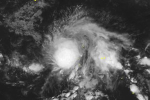
Updated as of October 2 early morning by the National Center for Hydro-Meteorological Forecasting, the tropical depression’s center was located at around 14.8 degrees North latitude and 129 degrees East longitude, off the eastern coast of the Philippines, with maximum sustained winds of level 7 (equivalent to 50–61 kilometers per hour), gusting to level 9. It was moving west-northwest at about 15 kilometers per hour.
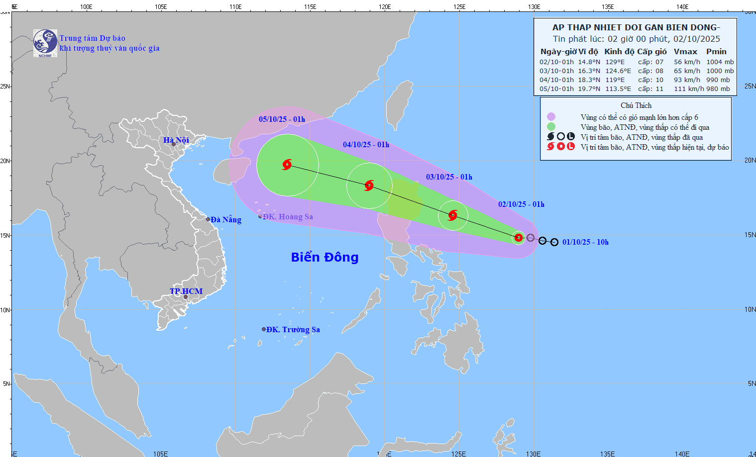
The weather agency forecasts that within the next 24 hours, the tropical depression is likely to strengthen into a storm.
By 1 a.m. on October 3, this system will approach the area near Luzon Island, the Philippines, with winds of level 8–9, gusting to level 10. The storm will then move faster, at about 25 kilometers per hour, crossing Luzon Island into the East Sea, where it may intensify to level 10 with gusts above level 11.
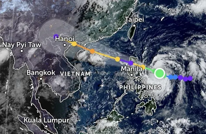
Both the Japan Meteorological Agency (JMA) and the U.S. Joint Typhoon Warning Center (JTWC) said that the tropical depression east of the Philippines is forecast to develop into a storm as early as today, October 2.
According to the JMA’s forecast map, the storm is expected to move slightly northward and head straight into the East Sea by the evening of October 3, becoming storm No. 11 in the East Sea this year.
The JTWC predicted that the storm would move toward China’s Leizhou Peninsula and is highly likely to affect the Gulf of Tonkin.
Meanwhile, Vietnam’s National Center for Hydro-Meteorological Forecasting (NCHMF) also issued this scenario, warning that the Gulf of Tonkin will experience extremely dangerous weather in the coming days.
After several days of prolonged showers and thunderstorms, October 2 morning skies in Hanoi, Ho Chi Minh City and other parts of the country has become clear again.
According to the National Center for Hydro-Meteorological Forecasting (NCHMF) and climate experts, most areas nationwide experience less rain, and plenty of sunshine on October 2.
Only Ha Giang and some coastal areas of the Southern region are expected to see scattered morning showers, while in the afternoon, light rain may occur in parts of the South and Central Highlands, but with lower intensity compared to October 1.
Fishermen in coastal areas of the North and Central regions are recommended to closely monitor storm updates in the East Sea and avoid going offshore or entering dangerous areas in the middle and northern parts of the East Sea in the coming days.
