According to the National Hydrology Meteorology Forecast Center, new tropical low pressure has just appeared in the northern territorial water of East Sea yesterday evening.
.jpg)
Tropical low pressure mainly moves westwards. (Source: the National Hydrology Meteorology Forecast Center)
At 8am today, the depression was located at 21, 9 degrees north latitude and 115, 1 degrees east longitude at 110 kilometers of the southern part of Hong Kong (China). Its maximum wind was measured near the center at level 6-7, even gusts up to level 9- 10.
In next 24 hours, the tropical pressure is going to move at 10 kilometers per hour, and after that it is forecast to develop into the typhoon.
By 7am tomorrow, it will be positioned at 21, 7 degrees north latitude, 112, 8 degrees east longitude at 270 kilometers of Leizhou Peninsula (China) with its powerful wind of level 8- 11 after that develop into the typhoon.
Because of the influence of its circulation, the northern territorial water of East Sea will see strong wind of level 6- 11 by tonight.
Meanwhile, both Gulf of Tonkin and the northern East Sea will suffer medium- heavy rains, thunderstorms and powerful wind speed.
Within next 24- 48 hours, the typhoon will mainly move westwards at 10 kilometers.
During this week, a heavy rain will appear in the northern and northern central region on the large scale.
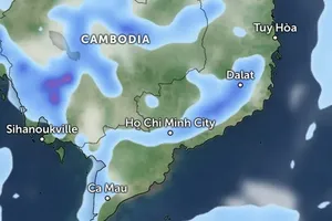
Moreover, the powerful operation of the southwest monsoon will directly affect to the weather condition in the southern territorial waters from Binh Thuan to Ca Mau and Spratly Island. Wind blows at level 6- 9, and sea rough.


)


