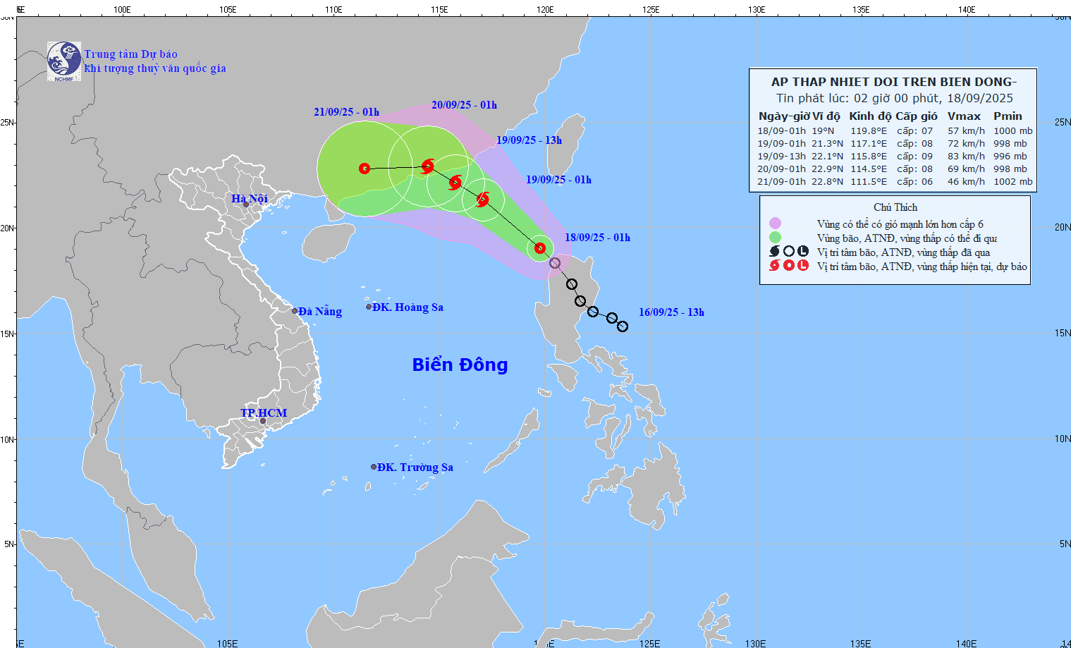
The system is forecast to unlikely impact on the mainland of Vietnam.
As updated by the National Center for Hydro-Meteorological Forecasting on the morning of September 18, the tropical low-pressure system formed over the northwest waters of Luzon, the Philippines, and then entered the East Sea on the evening of September 17.
At 1 a.m. on September 18, the center of the tropical depression was located at 19 degrees North latitude, 119.8 degrees East longitude, in the northeast waters of the northern East Sea, with maximum sustained winds of 50–61 kilometers per hour, gusts up to 90 kilometers per hour moving northwest at 15–20 kilometers per hour.

The National Center for Hydro-Meteorological Forecasting said that the tropical depression is forecast to intensify into a typhoon by the morning of September 19, with wind speeds reaching over 74 kilometers per hour.
The danger zone currently spans north of 18 degrees latitude and east of 115.5 degrees longitude. Disaster risk is rated at level 3.
From September 19 to September 20, the typhoon is forecast to persist northwest at about 15 kilometers per hour, with its center projected to be over the southern Guangdong by the morning of September 20.
Over the next 48–72 hours, the system is expected to move westward, moving about 10 kilometers per hour and gradually weakening.
In the northeastern waters of the northern East Sea, winds will strengthen to levels 6–7, with gusts of level 9. Near the typhoon center, winds could reach level 8 with gusts of level 10, along with rough seas.
Authorities continue to warn of dangerous conditions for ships operating in the northern East Sea.


)


