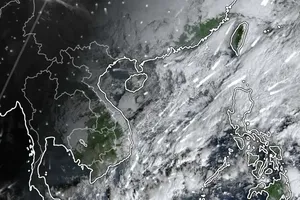
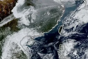
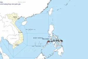
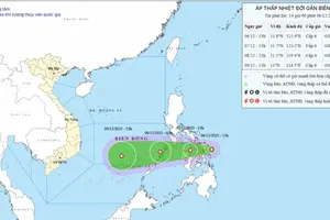
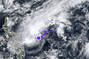
Storm Maysak was located at 390 kilometer of east southeastward of Philipines’ Luzon Island, at 15, 1 degrees north latitude and 125, 2 degrees east longitude on Sunday, reported the National Hydrology Meteorology Forecast Center on April 4.
The storm sustained wind speeds of level 11- 14 near center. By morning Sunday, the storm moved toward west northwest, with its speed of 20- 25 kilometers an hour, and later it is predicted to enter East Sea. By evening of the same day, Maysak will locate at 17, 9 degrees north latitude and 120, 6 degrees east longitude at the western territorial water of Luzon island, with its strongest wind speed of level 8- 10.
In next 24- 48 hours, the storm is predicted to move toward northwest, with its speed of 15- 20 kilometers an hour, and then it will enter the northeastern territorial water of East Sea, with wind speed of level 8. After entering East Sea, Maysak will weaken into a tropical low pressure zone.
By Monday, the tropical low pressure will be at 20 degrees north latitude and 117, 5 degrees east longitude, at 690 kilometers of northeastward of Paracel Island. The strongest wind near center will blow with level 6- 8.
In next 48- 72 hours, the tropical low pressure will move slowly toward west northwest, with its speed of 10 kilometers an hour.
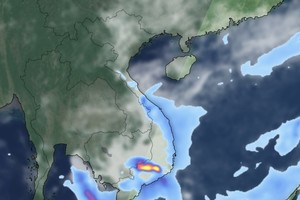
In related weather news, an ongoing hot weather has occurred in the areas of the northwestern, north central and central provinces. The highest daily temperature was measured at 34- 37 degrees Celsius, some place at over 38 degrees Celsius. According to weather forecast, the heat wave will maintain on April 6 in the areas. The highest temperature in Ho Chi Minh City will be at 34- 35 degrees Celsius in next days.
