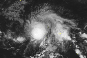
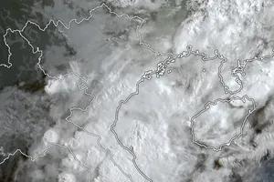
As of 7 a.m. on October 18, the storm’s center was located around 13.1 degrees North latitude and 126.5 degrees East longitude, over the eastern waters of the central Philippines. The strongest winds near the center of the storm reached category 8 (equivalent to 62–74 kilometers per hour), with gusts up to category 10. The storm is moving westward at about 20 kilometers per hour.
Following forecasts from both the National Center for Hydro-Meteorological Forecasting and international meteorological agencies, in the next 48 hours, storm Fengshen will move west-northwest, crossing the central Philippines before entering the East Sea around October 20.
After entering the East Sea, the tropical storm is expected to intensify further, potentially becoming the 12th storm to affect Vietnam this year.
This storm is expected to take a complex and unpredictable path. Forecast models show that its path may be impacted by a cold air front from the north, which could make the storm's path be bent or changed.
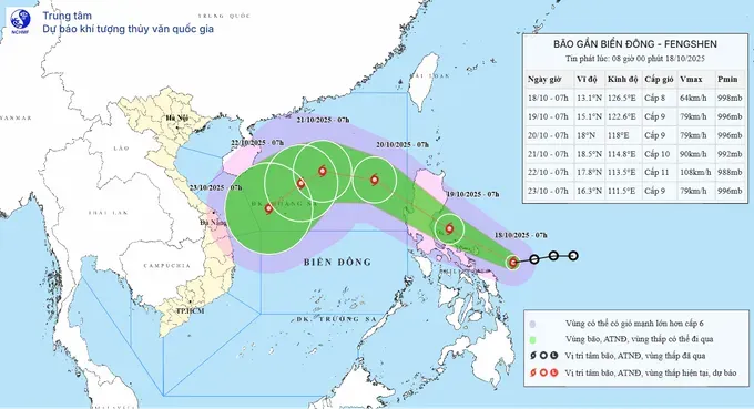
According to Vietnam’s meteorological authorities, storm Fengshen may generate strong winds, rough seas and heavy, widespread rainfall across the middle and southern parts of the East Sea, and later affect offshore waters of the central and south-central coast.
Therefore, the Central coastal provinces need to remain on high alert, closely monitor the storm’s developments, and prepare early safety measures for vessels and fishermen operating at sea.
Meteorological experts also predict that the Central region is likely to experience torrential rainfall in the coming days when a cold air mass interacts with the storm. The rain may extend across the western slopes of the Truong Son Range, potentially causing flooding along the Mekong River.

