The national meteorological agency reported that under the influence of an activated Southwest monsoon, Southern Vietnam on September 17 continues to face widespread showers and thunderstorms, while a tropical depression in the East Sea is forecast to intensify into a storm.
The National Center for Hydro-Meteorological Forecasting announced on the morning of September 17 that heavy rain and thunderstorms struck areas from Hue to Khanh Hoa overnight and early morning. Rainfall between 7 p.m. on September 16 and 3 a.m. on September 17 reached significant levels in several places. Specifically, Quang Dien (Hue) recorded 68.2mm, Ia Kenh (Gia Lai) 88.4mm, and Song Hinh (Dak Lak) 51.8mm.
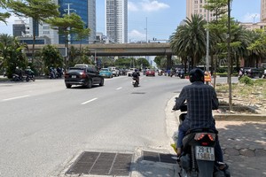
The center warned that from the afternoon through the evening of September 17, showers and thunderstorms will persist across regions from Hue to Lam Dong and the Southern provinces, with average rainfall ranging between 15 and 30mm, and localized downpours exceeding 80mm.
As for the tropical depression, at 1 a.m. on September 17, its center was located near latitude 16 degrees North and longitude 122.3 degrees East, east of Luzon (Philippines), packing winds of 50–61 km/h (Force 7), gusting to Force 9. The system is moving west-northwest at around 15 km/h.

Within the next 24 to 48 hours, the depression is likely to strengthen into a storm (Force 8, gusting Force 10). Between September 18 and 19, the storm is forecast to intensify further to Forces 8–9, gusting to Force 11, and potentially enter the East Sea. Authorities have issued a Level-3 natural disaster risk warning for the northeastern waters of the East Sea.
")
From the night of September 17, strong winds are expected in the northeastern East Sea, reaching Forces 6–7, gusting Force 9. Near the storm’s center, winds may reach Force 8, gusting Force 10, with waves 2.5–4.5 meters high, causing rough seas. Vessels operating in the affected areas are urged to take precautions against thunderstorms, whirlwinds, strong gales, and high waves.