As of 8 a.m. on October 23, the National Center for Hydro-Meteorological Forecasting (NCHMF) issued its final advisory on storm No. 12, internationally named Fengshen.
According to the agency, early this morning, the tropical storm weakened into a low-pressure area after entering the coastal waters between Hue and Da Nang. In the next 12 hours, this low-pressure zone is expected to continue moving southwestward and gradually dissipate.
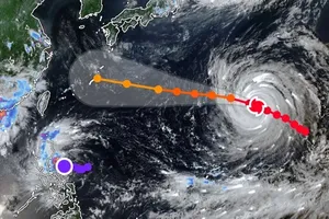
Another new tropical depression has developed farther offshore and is showing signs of moving into the northern East Sea.
As of 8 a.m. on October 23, the tropical depression’s center was located near 20.4 degrees North latitude and 121.4 degrees East longitude, with maximum sustained winds of force 7 (equivalent to 50–61 kilometers per hour) and gusts reaching force 9. The system is currently tracking southwestward at a speed of around 20 kilometers per hour.

According to the national meteorological agency, the center of the tropical depression is expected to move into the northern part of the East Sea within the next 24 hours.
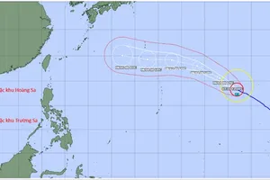
By around 7 a.m. on October 24, the system’s center is forecast to be near 17.7 degrees North latitude and 117.9 degrees East longitude, over the eastern waters of the northern East Sea. It will continue moving south-southwestward at about 20 kilometers per hour.
At 7 a.m. on October 25, the tropical depression is expected to maintain its southwestward track at the same speed, reaching approximately 15.5 degrees North latitude and 114.1 degrees East longitude, about 250 kilometers east of the Paracel Archipelago.
At that time, the system is forecast to weaken gradually, with maximum winds dropping below category 6.
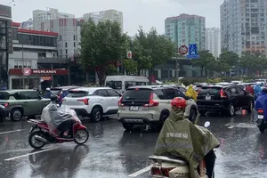
While storm No. 12 no longer directly influences marine weather, the new tropical depression is expected to generate rough and dangerous conditions across the northern East Sea over the next one to three days.
Fishing vessels and marine operations in the affected area should be prepared for thunderstorms, strong winds and rough seas.