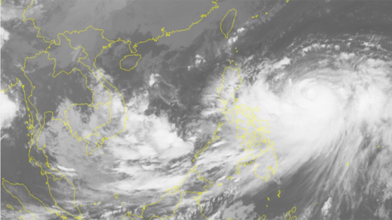
Yesterday evening, it was located at 11.5- 12.5 degrees north latitude and 116.5- 117.5 degrees east longitude at around 320 kilometers of the east- northeastward of the Song Tu Tay (Southwest Cay) Island of the Spratly Islands.
The tropical low pressure zone is moving the east- northeastward at 5-10 kilometers an hour, and it is expected to develop into the tropical depression in the next few hours.
By this evening, its eye will be at 12.5 degrees north latitude and 119 degrees east longitude at 150 kilometers of the north- northwestward of the Philippines’ Palawan Island with the maximum wind near the center of 40-60 kilometers per hour.
In next 24- 48 hours, the depression will continue moving the east- northeastward at 10- 15 kilometers an hour.
At present, the tropical low pressure zone has operated in the south- East Sea and is forecast to develop into the depression.
Because of its influence, the eastern territorial water of the mid- East Sea including the Spratly Islands saw powerful wind of level 5-9 and sea rough while the south- East Sea including the Spratly Islands and the southern territorial waters from Binh Thuan to Ca Mau experienced showery weather, thunderstorm, the southwest monsoon of level 5-8 and big waves of 2-3 meters.
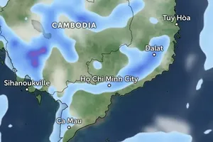
The weather in the areas of Ho Chi Minh City and the southern provinces has been impacted by the southwest monsoon, tropical convergence and cold front, causing medium- heavy rains in the central, south- central, the south- central highlands and the southern provinces on October 19.
The highest rainfall in the provinces of Quang Tri, Thua Thien- Hue, Quang Nam, Dak Lak, Dak Nong, Lam Dong as well as the southern provinces is measured at 50- 150 mm.
Landslide and flash flood are warned to occur in the areas from Ha Tinh to Quang Ngai, Ninh Thuan and Binh Thuan.
Statistics showed that flash flood and landslide had caused 148 deaths and missing ones, destroyed public constructions since the mid- June. Total damage value is estimated at VND 3 trillion (US$ 13 billion)









)


