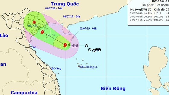
At 7am today, the dangerous zone is located at around 450 kilometers from the Paracel Islands.
Within the next 24- 48 hours, the tropical depression is forecast to slowly move west- northwestward at 15- 20 kilometers an hour, and then it is able to operate violently.
By 7am Wednesday, its eye is expected to be at 220 kilometers from Hainan Island of China with a maximum wind speed of 50-60 kilometers an hour near the center.
After that, the tropical depression will continue moving west- northwestward at a speed of 10 kilometers per hour and possibly become a storm.
Because of a powerful operation of the southwest monsoon, the territorial waters from Binh Thuan to Ca Mau, the South- East Sea and the Spratly Islands will suffer sustained winds of level 5-8, big waves of 2-3 meters and rough sea from Tuesday.










)
