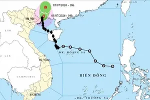
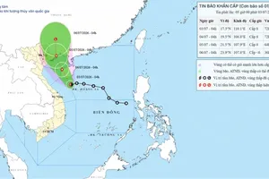
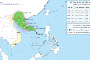
As of 4 a.m. on June 10, the tropical depression was centered at approximately 15.7 degrees North latitude and 115.7 degrees East longitude, about 360 kilometers east-southeast of the Paracel Islands.
")
The strongest winds near the center reached 39 kilometers to 49 kilometers per hour. The tropical depression is moving slowly westward at a speed of about five kilometers per hour.
In the next 24 to 48 hours, the tropical depression is likely to strengthen into a storm, moving west-northwestward at a speed of 10 kilometers to 15 kilometers per hour.
By early morning on June 12, the eye of the storm is forecast to be located over the Paracel archipelago, at about 16.3 degrees North latitude and 111.7 degrees East longitude.