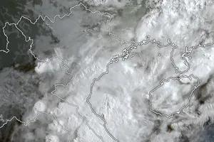
Specifically, by 1 p.m. on Monday, the eye of the tropical low-pressure system will locate at around 16.8 degrees north latitude and 112.2 degrees east longitude, about 200 kilometers far from the east of the Paracel Islands.
All vessels operating in the above-warned areas are under the impact of gales and big waves.
Under the influence of the tropical convergence range connecting with the development of the low-pressure zone and upgrade of the southwest monsoon, territorial waters from Binh Dinh to Ca Mau provinces, the middle and south-East Sea including the Spratly Islands will see powerful winds of up to level 8, rough sea and big waves of 2-4 meters.
Thundery showers along with risks of cyclones and gales will occur in the East Sea on the large scale comprising the Paracel Islands, Spratly Islands, the south of the Gulf of Tonkin, waters from Quang Tri to Ca Mau, from Ca Mau to Kien Giang and the Gulf of Thailand.
