Ho Chi Minh City People's Committee has approved a plan to launch a real-world testing sandbox for unmanned aerial vehicle (UAV) technology across the city. The move is considered an important step toward gradually creating dedicated UAV airspace and developing Ho Chi Minh City's low-altitude economy.
Multiple applications for daily life and production
In February 2026, the Ho Chi Minh City Department of Science and Technology, in coordination with Vietnam Post and CT UAV JSC, launched a UAV delivery route linking Can Gio Commune and Vung Tau Ward.
During the event, an actual postal package was transported by UAV from the ferry terminal in Can Gio Commune to the Tran Phu Street area in Vung Tau Ward, covering more than 12 kilometers each way. The flight took just 15 minutes, making it about six times faster than road transport and three times faster than waterway transport.
Earlier, in January 2026, the Ho Chi Minh City Department of Science and Technology worked with the Saigon Hi-Tech Park Management Board (SHTP) and technology companies to test UAV deliveries at SHTP. Although deliveries were mainly limited to lightweight packages within the park, the trial marked an important starting point for integrating UAVs into everyday life.
In the data sector, Ho Chi Minh City launched a UAV-based data digitization project in July 2026 covering 168 wards, communes, and special zone. The project was initially deployed in Tru Van Tho Commune and has since expanded to other areas including Bau Bang, Hung Long, Can Gio, Vinh Loc, Binh My, and Ben Cat.
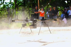
Under the project, UAVs weighing 3.5 kilograms are being operated with a maximum payload of 5 kilograms and a maximum flight time of 60 minutes without cargo. The devices can fly at speeds of 10-15 meters per second, have a maximum control range of 15 kilometers in obstacle-free conditions, and can withstand level-6 winds. The UAVs are equipped with 4K HD cameras featuring 6x hybrid zoom for aerial image collection.
In practice, UAVs can rapidly cover large areas and access scattered locations or sites that are difficult to observe directly. Images captured from above provide a relatively comprehensive view of land use, structures, transport infrastructure, water surfaces, and spatial changes over time, creating an important database for socio-economic development.
HCMC moves toward technology mastery
According to Chairman Nguyen Van Khoa of the Vietnam Low-Altitude Economy Alliance, aircraft are merely tools for collecting raw data, while the real economic value lies in converting point clouds into digital spatial twins. The value of the low-altitude economy is not found in individual flights but in the entire ecosystem of control systems, artificial intelligence, sensors, telecommunications, and data that collectively serve specific needs.
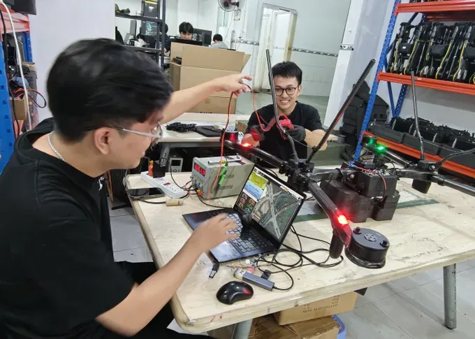
A domestic technology ecosystem is taking shape with the participation of companies such as Real-Time Robotics (RtR), Gremsy, Saolatek, and CT UAV (CT Group), alongside a growing range of domestically produced UAV products.
Among them, products manufactured by Real-Time Robotics, which operates a factory in Ho Chi Minh City, have achieved a localization rate of more than 90 percent and are exported to multiple countries. CT UAV is also accelerating its push into export markets.
CT Group recently announced that CT UAV and partner TJ Aerospace had inaugurated a joint-venture UAV assembly plant in Garden Grove, California, with the goal of supplying more than 100 UAVs per day, including drone models and electric vertical takeoff and landing (e-VTOL) aircraft.
Domestic technology companies have already developed the capacity to manufacture UAV equipment. However, broader deployment of UAVs and the development of a low-altitude economy will require significant additional work, particularly in building physical infrastructure networks such as landing sites, charging stations, flight operation centers, and logistics hubs integrated into urban planning, industrial parks, airports, and seaports.
The process from establishing a testing environment to mastering UAV technology reflects Ho Chi Minh City's step-by-step effort to build and shape a low-altitude economy.
According to Plan No. 200/KH-UBND dated May 18, 2026, issued by the Ho Chi Minh City People's Committee on developing the city's low-altitude economy through 2030, the model is based on the use of low-altitude airspace combined with low-altitude aviation technologies, new materials, new energy sources, big data, artificial intelligence, autonomous systems, next-generation telecommunications, and digital business models.
The Ho Chi Minh City People's Committee has assigned the Ho Chi Minh City High Command to work with the Air Defense-Air Force Service, Military Region 7 High Command, Ho Chi Minh City Police, the Ho Chi Minh City Department of Science and Technology, and other agencies to study and propose locations for the testing sandbox. Priority research areas include Can Gio, Cu Chi, and the North Ho Chi Minh City Science and Technology Urban Area.
The Ho Chi Minh City Department of Science and Technology is inviting and selecting technology companies, research institutes, and universities to invest in infrastructure, equipment, management platforms, and operating systems for the sandbox under a public participation model.
According to the department, once the testing process is completed, it will coordinate with relevant agencies to advise the Ho Chi Minh City People's Committee on considering the adoption of the results for state management purposes, as well as proposing the expansion of the model or assigning science and technology tasks.
The testing results may also serve as a basis for considering products for inclusion in pilot policy programs designed to promote commercialization, government orders, or public procurement in accordance with regulations when practical requirements are met.
Ho Chi Minh City’s development plan for the low-altitude economy through 2030 consists of three phases:
* 2026–2027: The city will focus on pilot projects, institutional refinement, and laying the foundation. Key tasks include establishing a controlled testing framework; developing spatial planning for low-altitude operations; defining no-fly zones, restricted areas, and potential flight corridors; and implementing human resource training programs.
* 2028–2030: The city will expand and accelerate commercialization.
* Beyond 2030: The city will intensify commercialization and diversify low-altitude economic services in alignment with priority sectors; moreover, the city will focus on research, technology transfer, and mastering core and foundational technologies to build a comprehensive ecosystem of technical infrastructure.
)