The Da Nang City Civil Defense Steering Committee on November 2 reported that the prolonged, record-breaking rains and floods from October 25 to October 31 caused severe damage across the city, with initial damage estimated at over VND837 billion (nearly US$32 million).
Rainfall in several areas exceeded 1,000 millimeters, while water levels on the Vu Gia River at Ai Nghia reached 10.6 meters, nearly matching the historic 2009 record. The Han River at Cam Le also peaked at 3.25 meters, surpassing the flood level recorded in 2009.
As of 2 p.m. on November 1, 230 households remained flooded, 10 communes and wards were completely isolated, and 30 other areas were still heavily inundated. Several national and provincial highways suffered partial traffic interruption.
Authorities mobilized over 36,200 personnel and 148 rescue vehicles to conduct emergency operations, evacuating 4,835 households, equivalent to 15,886 residents, to safety. Relief and supply efforts were promptly deployed to the isolated areas.
The disaster left 12 people dead, four missing and 47 injured.
Torrential rains and flooding also caused extensive property damage, with 78 houses collapsing, 269 others damaged, and 17 homes facing landslide risks.
In the agricultural sector, losses were extensive, including 55 hectares of rice, 718 hectares of vegetables, 73 hectares of crops, 27,000 poultry, 146 livestock and 167 hectares of aquaculture destroyed. Around 350 tons of food supplies were also ruined.
The city’s transportation infrastructure suffered severe destruction, with over 4.1 kilometers of roads washed away and more than 62,800 cubic meters of soil and rock eroded along key routes such as National Highways 14B, 14D, 14G, and the Ho Chi Minh Road.
The power grid sustained major damage, with 37 medium-voltage poles downed and about 4,000 meters of electrical lines damaged, causing power outages that affected over 512,000 customers.
Telecommunications were also disrupted, as numerous fiber-optic cables were severed in mountainous districts including Tra My, Tien Phuoc, Phuoc Son, Hiep Duc, Dai Loc and Nong Son. In total, 183 BTS stations lost connection, severely hampering command and rescue communication efforts.
The health sector suffered significant losses, with three hospitals severely flooded, including Quang Nam Regional General Hospital and Duy Xuyen Regional Medical Center, where water levels rose over one meter, along with 40 medical stations in areas such as Cam Le, Dai Loc, and Dien Ban inundated.
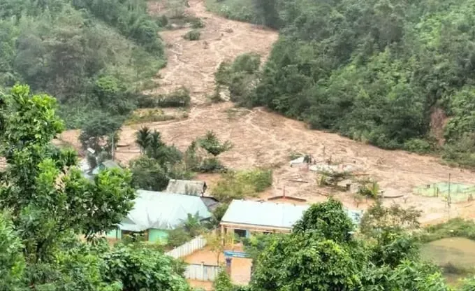
Other notable damage included coastal erosion along Hoi An Tay and Hoi An Dong beaches, stretching 3,450 meters and encroaching 25–30 meters inland. Additionally, a 20-meter section of the Ly Ly River dike in Xuan Phu Commune was breached, endangering 48 households, while the An Luong embankment in Duy Nghia Commune suffered four landslide points, with an estimated 1,160 cubic meters of soil, rock, and concrete displaced.
Initial damages are estimated at VND837.312 billion (US$32 million).
According to the Central Regional Hydro-Meteorological Station, as of 8:30 a.m. on November 2, multiple areas in Da Nang City continued to experience moderate to heavy rainfall.
Soil moisture models indicate that the entire region has reached a near-saturation level of over 95 percent, significantly increasing the risk of landslides.
Over the next six hours, Da Nang City is forecast to continue experiencing heavy rain, with total rainfall ranging from 20mm to 40mm, and over 70mm in some areas. There remains a high risk of flash floods in small rivers and streams in mountainous areas, as well as landslides and ground subsidence in several communes and wards.
Meteorological authorities have issued a level 2 natural disaster risk warning.


