As predicted, the El Nino-Southern Oscillation (ENSO) phenomenon is possible to continue cold phase neutral condition askew within the next couple months after that sea surface temperature in the Central Pacific region is able to become colder and turn into La Nina phenomenon with weak intensity in the last months of the year.
The outlook of 2020 hurricane season previously indicated a possible appearance of around 9 to 11 storms and tropical low depressions in the East Sea, including around 5 to 6 typhoons will directly affect the mainland of the Central and Southern regions in the last months of the year.
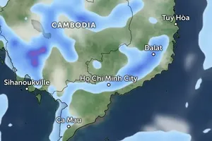
Risk of thunderstorm, lightning, cyclone and hail are predicted to appear in many provinces and cities. Additionally, operation of the southwest and northeast monsoons will likely trigger cool blustery winds in the southern and northern parts of the East Sea respectively in August.
Average temperatures between August and September across the country are expected to increase 0.1 to 1 degree Celsius compared to the same period of previous years and nearly-normal temperature in the last three months of the year over the same period of previous years is predicted for the country.
By the first month of 2021, temperature across the country is able to decrease 0.1 to 1 degree Celsius over the same period of every year.
Notably, this year’s freezer spells will likely to come earlier than 2019 winter season.
Regarding hot weather, the North- Central and Mid- Central regions are warned of heat waves during August.





)


