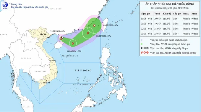
The National Civil Defense Steering Committee issued an official dispatch on the midday of August 31, urging coastal provinces and cities from Quang Ninh to An Giang—including Ho Chi Minh City—to prepare for a tropical depression that could strengthen into a typhoon, bringing heavy gales at sea.
The National Civil Defense Steering Committee asked localities and ministries to closely monitor developments of the tropical depression and strong winds at sea.
Coastal localities were requested to strictly control vessels heading offshore, organize vessel counts, and promptly notify vessel owners and captains operating at sea of weather developments so they can proactively take preventive measures, move out of, or avoid entering dangerous areas.
The National Civil Defense Steering Committee identified the hazard zone for the tropical depression over the next 24 hours as 18 degrees North latitude and from the 109.5th to the 114.5th meridian, noting that these coordinates will be adjusted in subsequent forecast bulletins.
Rescue personnel and assets have been put on standby for immediate deployment. Coastal radio systems and national and local media outlets have been directed to step up coverage of the tropical depression to ensure local governments, vessel operators, and residents can proactively prepare.
The committee also instructed all units to maintain strict duty shifts, while relevant ministries and agencies coordinate with local authorities according to their specific mandates.
Earlier on August 31, the National Center for Hydro-Meteorological Forecasting reported that a low-pressure area weakened from typhoon Saudel moved from mainland Guangdong Province, China, to the waters east of the Leizhou Peninsula before re-strengthening into a tropical depression.
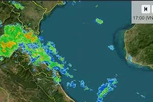
Indirectly affected by the system, the Gulf of Tonkin will see winds of level 5 (29–38 km/h) to level 6 (39–49 km/h) on August 31 and through the night, with gusts reaching level 7 (50–61 km/h) to level 8 (62–74 km/h). The sea area extending from southern Quang Tri to Ho Chi Minh City, along with the northern part of the southern East Sea, will experience strong southwesterly winds of levels 5 to 6, with gusts up to levels 7 and 8.
The northern and central East Sea will face strong winds of level 6 to 7, with gusts reaching level 8 to level 9 (75–88 km/h). Meanwhile, the waters from Ca Mau to An Giang and the Gulf of Thailand will see scattered showers and thunderstorms, with a high probability of tornadoes and strong gusts of levels 7 to 8.




)






