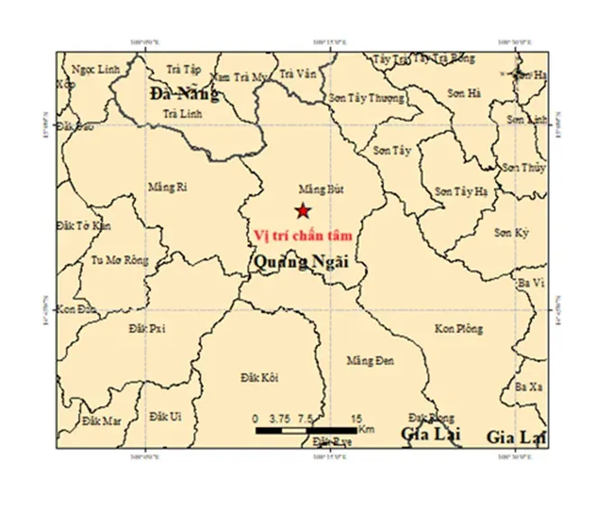
According to the Earthquake Information and Tsunami Warning Center under the Institute of Earth Sciences, a subordinate agency of the Vietnam Academy of Science and Technology, all six quakes occurred at a focal depth of approximately 8.1 kilometers.
Specifically, the first earthquake occurred at 12:41:16 a.m., with a magnitude of 4.0 on the Richter scale. Its epicenter was located at 14.904 degrees North latitude and 108.150 degrees East longitude, in Mang But Commune.
The second earthquake, with a magnitude of 3.0, occurred at 2:50:01 a.m. at coordinates 14.901 degrees North latitude and 108.174 degrees East longitude, also in Mang But Commune.
The third earthquake occurred at 3:07:55 a.m., measuring 2.9 on the Richter scale. Its epicenter was located at 14.886 degrees North latitude and 108.215 degrees East longitude, in Mang But Commune.
The fourth earthquake occurred at 3:09:13 a.m., with a magnitude of 3.2. Its epicenter was located at 14.869 degrees North latitude and 108.182 degrees East longitude, in Mang But Commune.
The fifth earthquake occurred at 3:26:11 a.m., measuring 2.8 in magnitude. Its epicenter was located at 14.879 degrees North latitude and 108.179 degrees East longitude, in Mang But Commune.
The sixth earthquake occurred at 3:28:22 a.m., with a magnitude of 2.6. Its epicenter was located at 14.881 degrees North latitude and 108.176 degrees East longitude, in the area of Mang But Commune.
The Earthquake Information and Tsunami Warning Center is continuing to monitor seismic activity in the area.