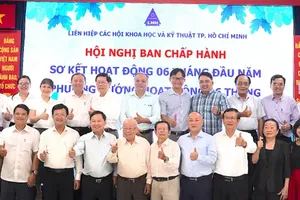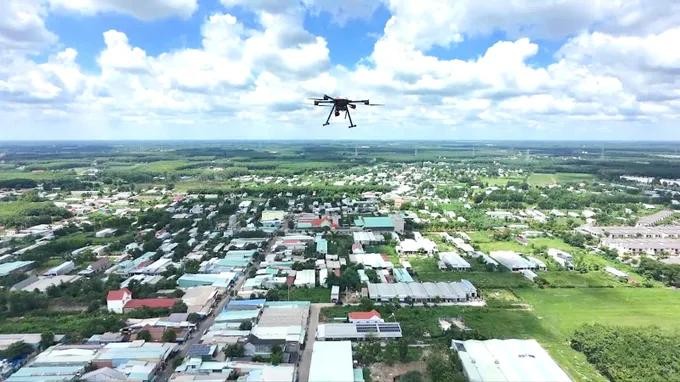
Ho Chi Minh City is implementing a project that uses unmanned aerial vehicles (UAVs) to survey local areas, create digital maps, and collect data to support government management across the city's 168 wards, communes, and special zones.
Ho Chi Minh City communes deploy UAVS for smart land management
Tru Van Tho Commune is the first locality in Ho Chi Minh City and in Vietnam to partner with the Ho Chi Minh City Department of Science and Technology in a pilot project using UAVs to document local conditions, collect aerial imagery, and build spatial data layers for local administration.
According to Luu Van Long, Secretary of the Tru Van Tho Commune Party Committee and Chairman of the Commune People's Council, the commune is a remote area of Ho Chi Minh City bordering Dong Nai City. It is home to the more than 700-hectare Cay Truong Industrial Park and the expanded Bau Bang Industrial Park.
The commune aims to significantly increase the share of industry, trade, and services in its economy by 2030 while promoting high-tech agriculture to raise residents' incomes. However, its large area, which includes residential neighborhoods, farmland, roads, and canals, has made management using traditional methods increasingly difficult.
After being selected for the pilot program, the commune began aerial surveys in June. Data collected by UAVs is providing the foundation for a visual, integrated database that can be updated regularly to support more effective local management.
Following Tru Van Tho Commune, the communes of Bau Bang, Tan Vinh Loc, Ben Cat, Can Gio, and Hung Long have also begun implementing the project.
Chairman Huynh Van Pham Hong of the Hung Long Commune People's Committee said the commune covers nearly 36 square kilometers and is urbanizing rapidly. Land administration, construction management, and planning have traditionally relied on field inspections, making it difficult to maintain a comprehensive overview or promptly detect illegal construction, unauthorized land use, or encroachment on canal corridors.
He said the commune has approved a plan to procure UAV-based technology services integrated with a Geographic Information System (GIS) to create a digital twin model. The system will build a spatial database, monitor changes in real time, detect violations involving land, construction, and the environment, and improve management and decision-making.
HCMC launches UAV project to drive low-altitude economy by 2030
Pham Huynh Quang Hieu, Deputy Director of the Ho Chi Minh City Department of Science and Technology, said the project is being carried out jointly by the department, CT UAV, and GASCO-LAE, a subsidiary of CT Group, under Plan No. 200/KH-UBND issued by the Ho Chi Minh City People's Committee on May 18, 2026, to develop the city's low-altitude economy through 2030.
Under the project, CT UAV is responsible for aerial surveys and digital mapping using drones, while GASCO-LAE is developing services related to the low-altitude economy.
Deputy Director Pham Huynh Quang Hieu said UAVs offer major advantages over traditional survey methods by covering large areas more quickly, accessing locations that are difficult to inspect directly, and generating integrated visual data that can be updated in real time.
The data reduces local governments' reliance on fragmented reports while providing new tools for analysis, forecasting, and decision-making.
The Department of Science and Technology is continuing to work with other agencies and local authorities to study a comprehensive service model for applying UAVs to urban management, construction oversight, forest management, high-tech agriculture, cargo delivery, and emergency medical services, to expand the technology to all 168 wards, communes, and special zones.
CT Group's UAV platform has a maximum flight time of 60 minutes, a control range of up to 15 kilometers, and a 4K high-definition camera for aerial data collection. According to the company, the system has an 87.5 percent localization rate and was designed, manufactured, and integrated by Vietnamese engineers.
Business Development Director Nguyen Van Vinh of GASCO-LAE said the pilot project in Tru Van Tho Commune demonstrated that combining UAVs with GIS technology can produce highly accurate two-dimensional and three-dimensional digital maps that integrate multiple layers of information and accurately reflect local conditions.
He said the platform provides an important foundation for managing urban areas, land, and infrastructure, monitoring changes in construction and land use, and supporting calculations of carbon credit reserves, contributing to green development goals.
The business development director revealed that during the pilot phase, participating localities are not required to pay any costs. GASCO-LAE is covering all expenses related to aerial surveys, UAV operations, data processing, production of two-dimensional and three-dimensional maps, and technical support.
After the pilot phase, the company said it will continue assisting local governments in operating the system, updating data, and refining the platform to maximize its effectiveness in public administration.