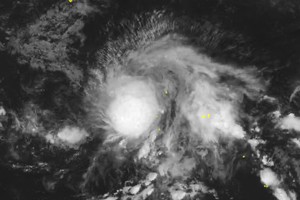
As of August 20 late, the National Center for Hydro-Meteorological Forecasting reported that strong disturbances in the northwestern Pacific could develop into a tropical depression or storm.
These weather systems are expected to move into the East Sea after August 25, potentially affecting Northern and Central Vietnam.
. (Source: WINDY)")
Therefore, the Northern region may experience worsening weather conditions in late August.
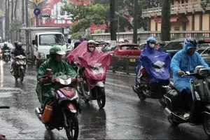
In particular, the Northern region is forecast to experience torrential rains mostly at night and in the morning, from August 21 to August 23. Rain is expected to decrease, but from August 26, widespread showers and thunderstorms will increase again, with a risk of moderate to heavy rainfall.
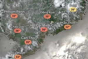
Meanwhile, the Central region will enjoy mostly sunny conditions, with some areas experiencing daytime temperatures above 35 degrees Celsius and thunderstorms at night from August 21 to August 23, followed by scattered afternoon and evening showers and thunderstorms.
From August 24 to August 31, residents in the localities from Thanh Hoa to Hue need to prevent moderate to heavy rains, especially after August 26.
During this period, the Central Highlands and Southern regions will experience persistent afternoon and evening showers and thunderstorms.
Maximum temperatures are expected to range from 28–31 degrees Celsius in the Central Highlands and 31–34 degrees Celsius in the South.