 |
The Northern region possibly experiences rain again. |
On the evening of October 5, the National Center for Hydro-Meteorological Forecasting (NCHF) informs that a continental high-pressure system is moving from the North towards the South, with an increasing tendency to shift eastward.
The forecast predicts that, owing to the influence of the Southwest edge of the continental high-pressure system extending further eastward and in conjunction with wind convergence at altitudes above 1,500 meters, there will be showers and thunderstorms in the North from the evening of October 6 to the morning of October 7. Particularly in the mountainous and midland areas, moderate rainfall is expected, with some locations experiencing heavy rain, with rainfall of 20-40mm and over 70mm in some areas.
"Thunderstorms may bring the risk of tornadoes, lightning, and strong gusty winds. Localized heavy rainfall can lead to flooding in low-lying areas and an elevated risk of flash floods and landslides in mountainous regions," the weather agency warns.
Weather alert centers across the Asia-Pacific region and meteorological experts anticipate that Northern Vietnam will encounter Northeast winds around October 7. Additionally, during October, there is an expected gradual rise in cold air pressure in the Northern region.
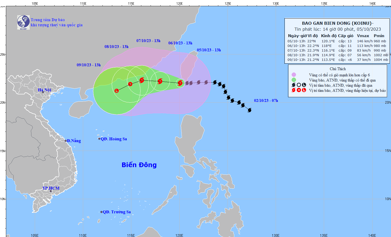
Regarding Typhoon Koinu, the meteorological agency reports that its current position is approximately at 22 degrees North Latitude and 120.1 degrees East Longitude, situated over the sea to the Southwest of Taiwan Island (China). The typhoon is currently at levels 12-13, with gusts reaching level 16.
 |
The location of Typhoon Koinu on the afternoon of October 5 |
The NCHF forecasts that Typhoon Koinu is expected to move into the East Sea on October 6 and gradually weaken. Between the 6th and 7th of October, the typhoon is primarily moving Westward at a speed of approximately 10 km/h, with its intensity decreasing to levels 10-11 and subsequently to levels 8-9.
By October 8, the typhoon is anticipated to weaken into a tropical low-pressure system over the sea to the Southeast of Guangdong Province (China).


