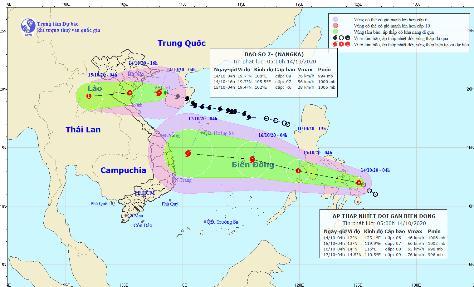
At 4AM today, the eye of tropical depression was located at around 12 degrees north latitude and 125.2 degrees east longitude.
In the next 24-48 hours, it is expected to travel the west- northwestward at a maximum –hourly speed of 25 kilometers, continue to approach the East Sea and turn into a new storm.
By the morning of October 15, the storm will be at around 600 kilometers far from east- northeastward of the Southwest Cay islet.


)