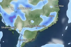
After new tropical low pressure system appeared in the center of East Sea, it directly affected to weather situation in the central and southern provinces, reported the National Hydrology Meteorology Forecast Center on June 26.
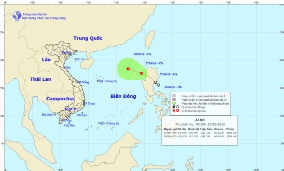
New troppical low pressure will enter East Sea in next two or three days. (Source: the National Hydrology Meteorology Forecast Center)
Yesterday evening, it was centered at 11, 5 degrees north latitude and 13, 5 degrees east longitude. Because of the influence of low pressure circulation, medium- heavy rains covered the provinces from Da Nang to Binh Thuan, Central Highlands and southern region. The highest rainfall in some places like Binh Thuan, Dak Lak and Dak Nong province was measured at 57- 89 mm.
Within next 24 hour, the tropical depression is going to move slowly towards north- northwest.
Today, the low pressure circulation is forecasted cause medium- heavy rains and thunderstorms in the territorial waters from Da Nang to Binh Thuan, Central Highlands and the southern region. Local residents need to pay attention to cyclone and strong wind in the powerful thunderstorm.
The weather situation of landslide and flood tide is predicted to hit local rivers from Quang Nam to Binh Thuan and Central Highlands.
Besides, the southern territorial waters from Binh Thuan to Ca Mau, Ca Mau to Kien Giang, Gulf of Thailand and Spratly Island will suffer sea rough, 2-3 meter big waves and wind speed of level 5- 8 due to effect of the strong operation of low pressure circulation and southwest monsoon,
According to information from the Hydrology Meteorology Forecast Centers in Asia- Pacific region, one more tropical depression has just appeared in Philippines.
It was yesterday located at 15,4 degrees north latitude and 122,7degrees eat longitude, and then it is going to enter East Sea in next two or three days.
The appearance of its circulation caused small- heavy rains in the areas of Ho Chi Minh City and southern provinces at night, with its peak temperature of 29- 30 degrees Celsius.









)


