In the next month, an average temperature in the country is able to increase by 0.5- 1 degree Celsius higher than the same period of recent years, notably the temperatures in the Northern and North-Central regions will raise 1-2 degrees Celsius over the same period annually.
The Southern region normally enters into the rainy season from May making the weather more comfortable and milder. However, this year, the Southeastern provinces are forecast to experience several-day hot waves in the end of April and the first half of May.
Meanwhile, extreme hot waves tend to come the Northwestern, Northeastern, North- Central and Mid- Central regions from May, from May to June and from April to August respectively.
This year's hurricane season hitting the East Sea tends to begin later than every year with the number of tropical typhoon hitting the East Sea in the year tending to be more than the average of the previous year and approximately the average of many years.
Particularly, about 11-13 storms and tropical low pressures are likely to appear in the East Sea, of which 5-6 ones will directly impact on the mainland of the Central and Southern regions during the peak months of the 2020 hurricane season.
According to the latest update from the National Hydrology Meteorology Forecast Center, there have been an extreme scorching temperature of over 35 degrees Celsius along with 45 to 60-percent humidity in air.
The highest temperature in the provinces of Dong Nai, Hau Giang, Quang Binh and Thua Thien- Hue is expected to exceed 35 degrees Celsius.
Due to an influence of the southern edge of a low pressure trough connecting with a hot low pressure zone from the westward, the roasting climate will cover the whole Northern and Mid-Central regions with an average temperature of over 38 degrees Celsius and air humidity fell somewhere between 30 percent and 60 percent within the next couple days.
In this period, the sweltering temperature of over 37 degrees Celsius and air humidity of 40-60 percent are predicted to hit the Southern region on the large scale.
As of April 24, hot weather will tend to gradually decrease in the Southern region.
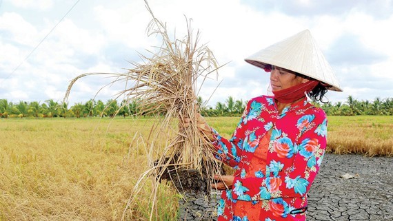
According to NCHMF, a total rainfall in Mekong Delta is much lower than the same period of last year falling from April to June which is almost equal to the average of many years starting from July to September.
The rainy season is potential to run from the mid-June, later than the same period in 2019 and the average of many years.
From March to the end of the 2020 dry season, the total flow volume pouring to the Mekong River will reach 15 percent to 20 percent lower than the average many years and be almost equal to the same period of 2016.
This year's hurricane season hitting the East Sea tends to begin later than the average of many years meanwhile this year’s flooding season in upstream of the Mekong River is also forecast to fall in the period of June to September.
The weather experts predicted the probability for below-normal flash flood in the upstream Mekong River. Besides that, the Mekong floodwater levels are able to peak at alert level 1 to 2 being 0.2-0.4 meter lower than the flood peak of many years.
The Department of Crop Production under the Ministry of Agriculture and Rural Development said that in case of the low-level floodwater, the Mekong Delta could produce up to 750,000 hectares of the 2020 autumn-winter rice crop, an increase of 27,000 hectares over the same period in 2019 with its production of nearly 4.2 million tons, an increase of 224,000 tons over the same period of 2019.
However, it is necessary to closely monitor flood and storm situation and strengthen controlling this year’s summer-autumn rice production to proactively find appropriate solutions for the autumn-winter crop.


)


