The Central Hydrology Meteorology Forecast Center yesterday reported that a tropical low pressure zone has brought medium- heavy rains, thunderstorm and strong wind on East Sea as it combined with on-going depression trough.
According to weather forecast, the low depression trough and zone continue to cause downpour rains, thunderstorm and powerful wind in the northeastern and southern territorial water of East Sea today, including Spratly Islands, waters from Binh Thuan to Ca Mau, Ca Mau to Kien Giang and Gulf of Thailand.
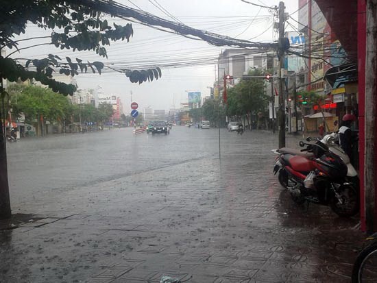
Due to impact of the weather situation, the weather in both Ho Chi Minh City and southern region has seen uninterrupted medium- heavy rains and thunderstorms in evening from August 27. Currently, the cold air operates strongly causing rains and powerful wind on the large scale.
According to the latest information from the National Hydrology Meteorology Forecast Center at 9am today, heavy rains covered the northern delta provinces with its rainfall of 50- 80 mm, even in some places of Ha Nam and Hai Duong over 90mm during six past hours.
Within 3- 6 next hours, uninterrupted heavy rains continue hitting the region on the large scale. Particularly, the peak rainfall in the provinces of Thai Binh, Nam Dinh, Ninh Binh, Hai Duong and Hung Yen will reach at 50- 80 mm. The highest rainfall in Hanoi city is measured at 20- 30mm.
Low areas of Thai Binh, Ninh Binh, Nam Dinh and Hai Duong may face flooding.


)