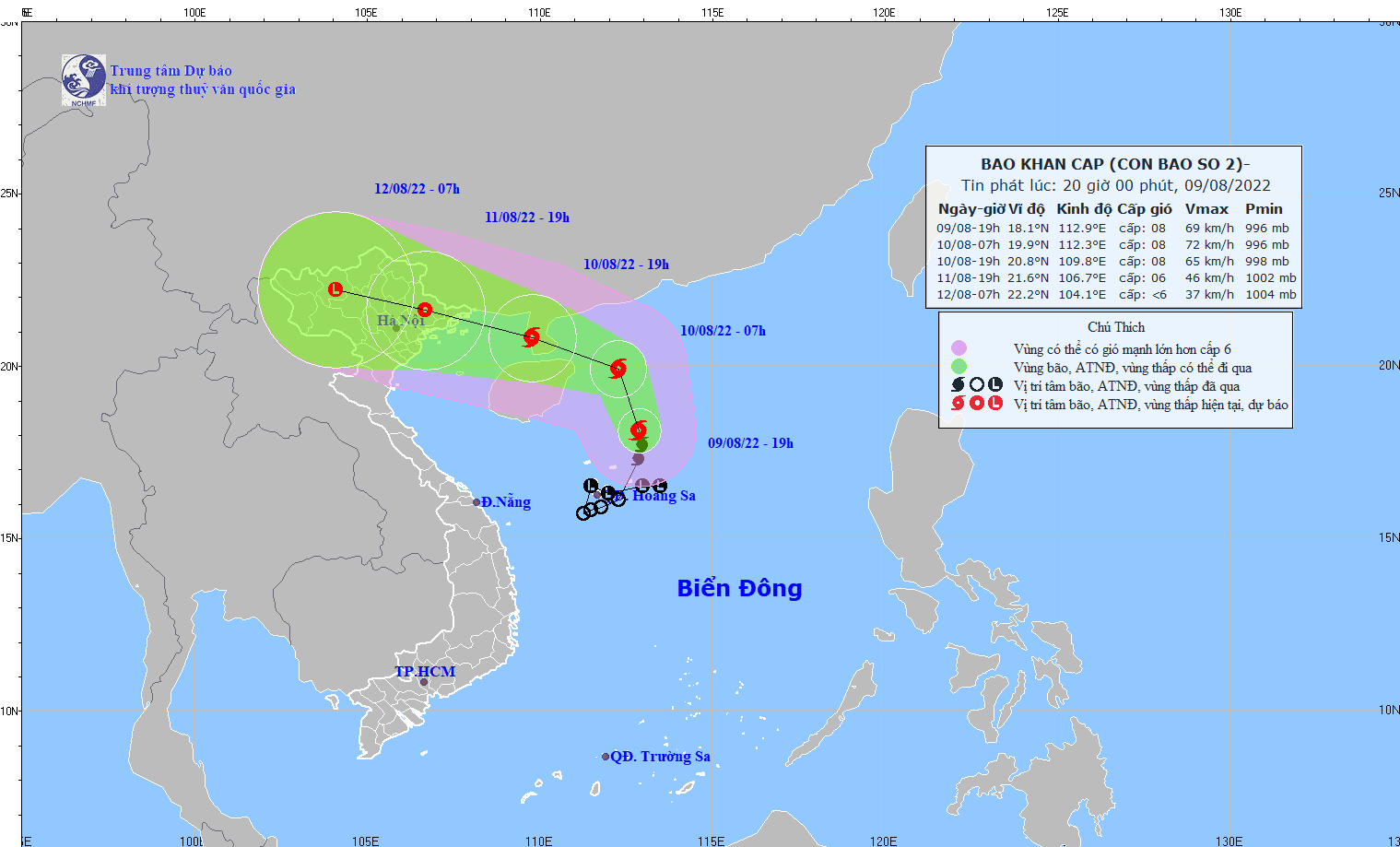
In the next 24 hours, Mulan is forecast to move mainly to the North, then to the Northwest, with a velocity of 15-20km an hour.
At 7:00pm today, the storm is predicted to be on Leizhou Peninsula (China), about 230km Southeast of Mong Cai City of Quang Ninh Province. The wind speed near the storm center will also be at level 8 (62-74km/hour), gusting to level 10. Disaster risk level is estimated at level 3.
In the next 48 hours, Mulan is expected to move West-Northwestwards, with a velocity of 15km/hour. It will quickly weaken into a tropical depression in the Northeast of the North of Vietnam. The wind speed at that time will be at level 6, gusting to level 8.
Under the effect of Mulan, the North of the East Sea (including the Paracel Islands) is now experiencing winds gusting to level 10, with 4-to-6-meter high waves and rough sea.
The Gulf of Tonkin including the island districts of Co To and Bach Long Vi from tonight will likely experience increased gales and rough surf, with winds gusting even to level 10 and 2-to-4-meter high waves.
Due to the strong Southwest monsoon, territorial waters from Binh Dinh to Ca Mau provinces, the middle and south-East Sea including the Spratly Islands will see powerful winds of up to level 9, rough sea and big waves of 2-4 meters.
Tonight and tomorrow in the coastal area of Quang Ninh Province, there will likely be gales and winds gusting to level 9.
From August 10-12, the North of Vietnam as well as the provinces of Thanh Hoa and Nghe An will see moderate to heavy rain of up to 250mm.


