Mr. Mai Van Khiem, Director of the National Center for Hydro-Meteorological Forecasting, shared key insights into this year’s climate and weather trends at the World Meteorological Day celebration, which coincided with the World Meteorological Organization (WMO) event, on March 24.
According to Mr. Mai Van Khiem, 2025 could be among the hottest years on record, with global temperatures projected to rise 1.29–1.53 degrees Celsius above pre-industrial levels. In Vietnam, while high temperatures will persist, the likelihood of surpassing 2024’s record remains low. ENSO is currently in a weakening La Nina phase and may shift to neutral by mid-year, increasing the risk of localized heavy rain, urban flooding, flash floods, and landslides.

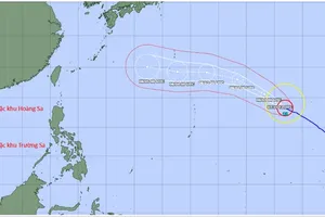
The East Sea is forecast to see 11–13 storms, with 5–6 directly impacting mainland Vietnam. The risk of severe storms reaching Level 12 or higher remains high.
Mr. Mai Van Khiem stressed that climate change predictions are becoming reality as the planet warms at an alarming rate. The past decade has recorded the highest temperatures in history, with ocean temperatures continuously reaching new peaks. This has led to a surge in extreme weather events, including intense heatwaves, devastating floods, and powerful storms.
According to WMO data, from 1970 to 2021, extreme weather events caused nearly 12,000 disasters, resulting in 2 million deaths and $4.3 trillion in economic losses. Despite this, nearly half of all countries still lack comprehensive early warning systems, leaving millions vulnerable to natural disasters without timely information. This gap highlights WMO’s push for the "Early Warnings for All" initiative.
At the event, Mr. Mai Van Khiem highlighted Vietnam’s extensive meteorological and hydrological monitoring network, which includes over 217 surface weather stations, nearly 2,000 automated rain gauges, 426 hydrological stations, 27 marine meteorological stations, and 10 advanced weather radar systems. This infrastructure enables real-time tracking, forecasting, and warnings for severe weather events such as typhoons, floods, droughts, and saltwater intrusion.
Vietnam has also integrated cutting-edge technologies, including the Cray XC40 supercomputer, satellite data assimilation, radar, and surface observations to enhance forecasting accuracy for heavy rainfall, flash floods, and landslides. Notably, the country’s landslide and flash flood warning system now provides district-level detail, helping local authorities and residents better prepare for natural disasters.