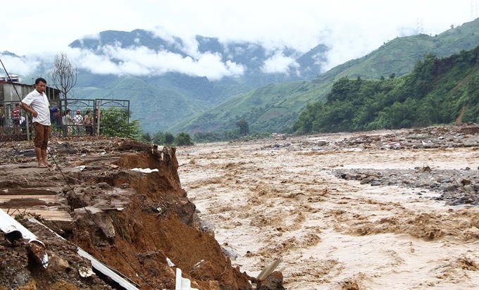
The meeting, organised in Hanoi by the Ministry of Agriculture and Rural Development, focused on flashfloods, landslides and quick assessments of safety in mountainous areas.
Participants stressed the need for early warnings of natural disasters in all localities.
It was noted at the meeting that in the coastal central province of Quang Nam, dozens of hectares of protective forests have been illegally chopped down between 2014 and 2016 in Ba To District’s Ba Lien Commune to get land for agricultural production.
Meanwhile, it is estimated that more than 1.2 million houses in various localities face the risk of damage or destruction by flash floods and landslides, the meeting heard.
Deputy Agriculture Minister Hoang Van Thang said it was imperative that comprehensive plans be made to tackle the situation.
All localities have to quickly finish compiling relevant data so that residents can be given early warnings of flashfloods and landslides, Thang said.
They should also set up rapid response task forces for all natural disaster related incidents in the future, he said.
Representatives from the localities said agencies responsible for forecasting and issuing warnings about natural-disaster risks have to improve their capabilities urgently.
Vu Ba Thao of the Vietnam Academy for Water Resources said quality of maps identifying flash flood sand landslide prone areas should be improved to better reflect the real situation.
He said current maps did not have details of time, location and levels of risks facing large areas on a provincial and regional scale.
Thao suggested that authorised agencies install soon a system of monitoring stations that issue warnings when nearby roads, construction sites and historical sites are at risk of flash floods and landslides.
This should be piloted in several major areas to gain experience, and then widely across the country, he said.
More severe
According to data from the Centre Steering Committee for Natural Disaster Prevention and Control, natural disasters killed 386 people and caused damages of VND60 trillion (US$2.6 billion) so far this year. The corresponding figures for the whole of 2016 were 264 and VND40 trillion ($1.75 billion).
The centre said Doksuri and Damrey were the strongest typhoons in three decades to batter the central region this year.
In October, unusual heavy rains in the north had forced the Hoa Binh Reservoir to open eight floodgates at the same time for the first time in a decade.
Besides, landslides on river banks in the Mekong Delta have also worsened this year.
Cold spell, Kai-tak
In a related move, the National Centre for Hydro-meteorological Forecasting yesterday warned that people in the north and north-central region would experience sharp drops in temperature as of yesterday midnight.
The temperature could reduce to 8-11 degrees Celsius in delta provinces and cities, and 4-7 degrees Celsius in the mountainous areas. Icy weather and frost are expected in high mountainous areas, the centre said.
The cold spell is expected to last 6-7 days. The spell could also blank the north and north-central regions with heavy rains from today.
The centre also said typhoon Kai-tak was heading to the East Sea. As of 1pm yesterday, the typhoon was about 250km off the Philippines’ central coastal area and moving west-northwest at 5km per hour. It is expected to enter the East Sea on Monday.
