At noon on November 19, the Civil Defense Command of Dak Lak Province reported that Song Ba Ha Hydropower Plant had increased its flood discharge to nearly 13,000 cubic meters per second, the highest level in the past 10 years. Forecasts indicate that by the afternoon, the discharge could rise to 14,000 cubic meters per second, comparable to the historic flood of 2009.

However, experts involved in mapping downstream flooding of the Ba River warned that this flood could be more severe than in 2009 due to the effects of urbanization and the construction of bypass roads and highways, which have significantly reduced the river’s natural flood drainage capacity.
The sharp increase in discharge is due to heavy rainfall from upstream. At the same time, other hydropower plants in the Ba River hydropower system are also releasing water such as Dak Krong over 7,000 cubic meters per second, and Krong H’nang more than 2,100 cubic meters per second.
According to warnings from the downstream Ba River flood map, if Song Ba Ha Hydropower Plant releases water at 14,000 cubic meters per second, more than 80 percent of the residential areas along the downstream river would be severely flooded.
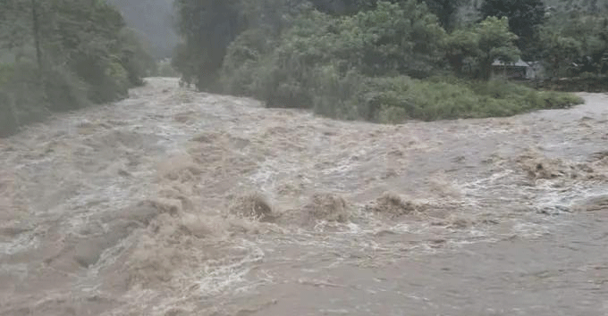
Despite not being directly affected by the Ba River hydropower system, prolonged heavy rain in the upper Ky Lo River basin has caused severe flooding in numerous areas of Tuy An and Dong Xuan, formerly in Phu Yen Province. In some places, water levels have reached up to 5 meters, and hundreds of households have sent out emergency distress signals.

National Highway 1, from O Loan Commune to Song Cau Commune, has been isolated by floodwaters, paralyzing traffic, with long queues of vehicles stretching for tens of kilometers.
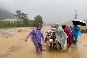
On the morning of November 19, prolonged heavy rain caused rivers and streams from upstream to overflow, leading to flooding and landslides across the eastern part of Dak Lak Province.

A leader of Song Cau Ward People’s Committee confirmed that at around 6 a.m., a large volume of soil and rocks suddenly slid down a slope, causing one house to collapse and one person to die on the site.
Reports indicate that in Dong Xuan, Phu Mo and Tuy An Bac communes, water levels have risen 4–5 meters, submerging many houses. Thousands of residents were forced to evacuate during the night.
Heavy rain has flooded numerous national highways, cutting off traffic. The Traffic Police Department of Dak Lak Province also reported that National Highway 29 has been partially submerged under 0.5–1 meter of water, isolating several areas and making it impossible for people and vehicles to pass.
Phuong Hoang Pass on National Highway 26, a section through Ea Trang Commune shows signs of landslides. In addition, many provincial roads in the area are heavily flooded and impassable.

In response to the ongoing natural disaster, Dak Lak Province People’s Committee Chairman Ta Anh Tuan issued an urgent directive calling on all levels of government to implement disaster prevention and response measures swiftly and decisively, with the top priority ensuring the absolute safety of residents’ lives; saving people.
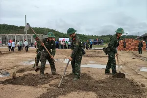
All military, police and local militia units have been mobilized to evacuate residents from hazardous areas.
Authorities are instructed to reach isolated and cut-off communities affected by flooding to provide timely assistance, including food, essential supplies and evacuation support. Staff are assigned to monitor and restrict access at all times to roads under water, low crossings and fast-moving flood zones.
Additionally, operators of hydropower reservoirs are required to strictly follow operating procedures, regulate water flow, maintain flood storage capacity, reduce downstream flood risks and provide early warnings to communities before releasing water.
Floodwater isolates more than 3,200 residents in Gia Lai Province
Heavy rain caused floodwaters to rise rapidly, overflowing into three hamlets, Plei Du, Bi Giong and Bi Gia, isolating 665 households with over 3,200 residents.


In Uar Commune, Gia Lai Province, on the morning of November 19, authorities evacuated 550 people from Nu Village, out of a total population of 2,221, to Nguyen Du No. 2 High School for shelter.