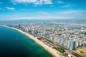
As of June 22, the Da Nang City People's Committee announced that the city will pilot a Digital Twin model between 2026 and 2028 as part of its strategy to strengthen urban management through data and accelerate smart city development.
.")
More than a three-dimensional representation of the city, the Digital Twin is envisioned as an integrated digital data environment that connects information on urban planning, land management, technical infrastructure, construction projects, transportation, environmental conditions and other specialized sectors on a single platform.
The system will enable authorities to visualize urban conditions in real time, monitor operations, conduct analyses, simulate development scenarios and support data-driven decision-making.
Under the proposal, the pilot phase will initially focus on urban planning management in selected priority areas. The city plans to build a Digital Twin platform, standardize and integrate data from multiple sources, develop 2D and 3D visualization models, and apply artificial intelligence (AI), geographic information systems (GIS), Internet of Things (IoT) technologies and advanced data analytics tools.
At the same time, Da Nang will establish governance and operational mechanisms to ensure the secure and effective management and use of data.
The project is expected to play an important role for the Da Nang High-Tech Park and Industrial Zones Authority (DSEZA), particularly in managing strategic functional areas such as the Da Nang High-Tech Park, industrial parks, concentrated information technology zones and the Da Nang Free Trade Zone (FTZ).
By digitizing and integrating data related to planning, infrastructure, land resources, environmental management, logistics and investment activities, authorities will be able to transition from manual monitoring to intelligent supervision and from reactive management to predictive, real-time data-driven operations.
The initiative is also expected to support the development of a next-generation free trade zone based on smart, green and digitally integrated principles. In addition, it will provide investors with faster and more transparent access to information while improving the management of development space, technical infrastructure, logistics networks and environmental resources.
DSEZA has already deployed a range of digital platforms, including Building Information Modeling (BIM), Geographic Information Systems (GIS) and specialized databases to support planning, infrastructure and investment management across the city's high-tech parks, industrial zones, IT parks and free trade zone.