According to the Department of Transport of HCMC, the route from HCMC to Tien Giang Province has a distance of about 110km and about 120km to Ben Tre Province.
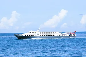
The expected waterway transport operators include Saigon Tourist Company, DP Green Technology Company, and Thuong Nhat Company. Each operator will put into use two vessels with a capacity of 75-151 passengers per vessel.
Inland ports and wharves are announced by competent authorities to serve high-speed ships to dock and pick up tourists.
In HCMC: High-speed wharf (Bach Dang Park - District 1); Saigon Port (Nha Rong Port, Khanh Hoi - District 4). In Tien Giang Province: My Tho Cruise Port (My Tho City). In Ben Tre Province: Rach Mieu Ferry Station (Chau Thanh District); Ben Tre Tourist wharf.
During the operation, ships must go nonstop and must not stop, park, or pick up passengers along the route.
There are two planned routes.
Route 1: departing from Bach Dang Wharf or Saigon Port, Nha Rong Port - Khanh Hoi → Saigon River → Nha Be River → Soai Rap River → Vam Co River → Cho Gao Canal → Tien River → inland ports and wharves in Tien Giang and Ben Tre provinces and vice versa.
The total length of the route is about 110km; the channel width is larger with little traffic of small vehicles, ensuring the operating speed of high-speed ships.
Route 2 (backup): departing from Bach Dang Wharf or Saigon Port, Nha Rong Port - Khanh Hoi → Saigon River → Nha Be River → Soai Rap River → Can Giuoc River → Nuoc Man Canal → Vam Co River → Cho Gao Canal → Tien River → inland ports and wharves in Tien Giang and Ben Tre provinces and vice versa.
The total length of the route is about 104km, 6km shorter than Route 1; however, the width of rivers and canals is narrow, with much traffic of small vehicles, limiting the operating speed of high-speed ships.

