The National Center for Hydro-meteorological Forecasting reported that a tropical low-pressure system has moved closer to the mainland of Da Nang and Quang Ngai Province.
As of 10 a.m. on September 25, the system was located at about 241 kilometers east- southeast far from Da Nang, and 165 kilometers east of Quang Ngai coast with gale-force winds of up to 39 kilometers an hour.
It is forecast that the depression will move toward the west-northwest near 15 kilometers per hour in the next three hours.
Affected by the tropical depression, the thundery showers, gale-force winds, rough sea and huge waves will slam the Paracel Islands, Spratly Islands, the Gulf of Tonkin, territorial waters from Quang Tri to Ca Mau, from Ca Mau to Kien Giang and the Gulf of Thailand.
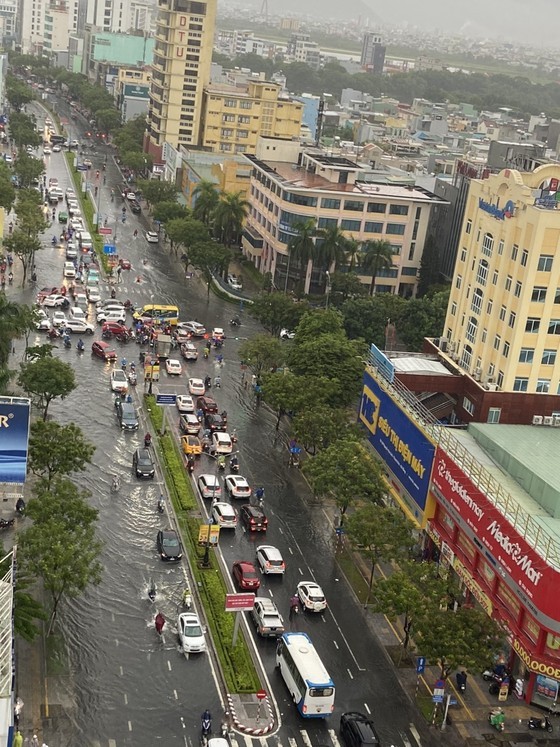
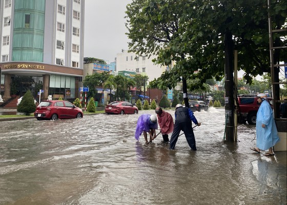
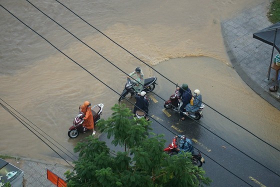
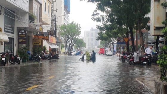
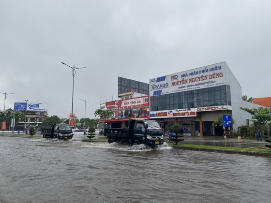
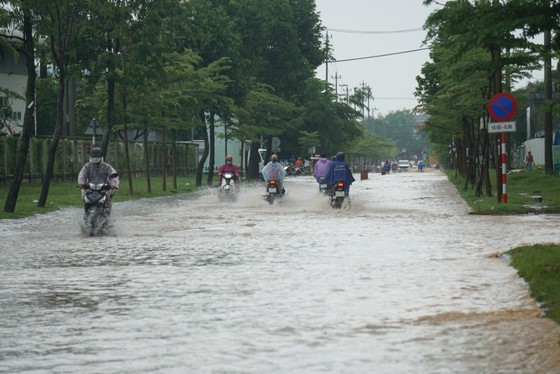
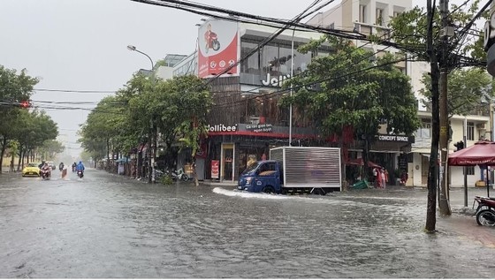
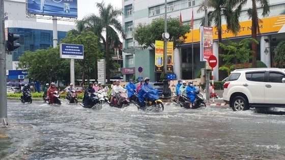
As of this morning, overnight downpours caused traffic chaos in Da Nang City where the tropical depression has been approaching and may slam in the next several hours.
Many vehicles were stranded in the floodwater, triggering serious congestion in the streets of Nguyen Van Linh, Ham Nghi, Le Quy Don, Le Duan, Nui Thanh in Hai Chau District, Cach Mang Thang 8 (August Revolution) Street and Truong Son in Cam Le District, Tran Hung Dao in Son Tra District, Ton Duc Thang and Nguyen Luong Bang in Lien Chieu District, Tran Cao Van in Thanh Khe District.
The traffic police were on duty on the congested roads to regulate traffic and ensure the safety of workers and students. The environmental forces were also present in deeply flooded areas to unclog drains.
According to the National Center for Hydro-meteorological Forecasting, Da Nang City has suffered from moderate and torrential rainfalls.
Some photos featuring traffic chaos in Da Nang City after overnight downpour.
By Huong Giang, Xuan Quynh, Pham Nga- Translated by Huyen Huong


)


