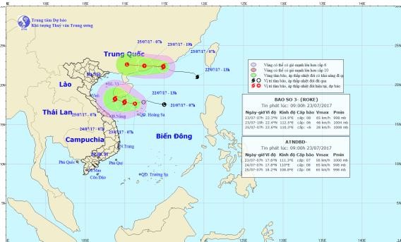
The system was centered 150 kilometers southeast of Hainan Island, China at 7 a.m. this morning. Wind power near the center of the system reached level 7 moving 50-60 kilometers an hour.
In the next 24 hours, the tropical depression is expected to move west at 5 kilometers an hour and might intensify into a typhoon tomorrow. The eye of the storm will locate south of the island. Wind power will increase to level 8 travelling 60-75 kilometers an hour.
The typhoon will move west northwest at the same speed to locate 340 kilometers east southeast off the coast from Ha Tinh to Nam Dinh provinces on Tuesday.
Under influence of the intensifying system, the northern, middle and southern parts of the East Sea comprising the Hoang Sa (Paracel) and Truong Sa (Spratly) Islands have been rough and choppy.
The water off provinces from Binh Thuan to Ca Mau, Ca Mau to Kien Giang and the Gulf of Tonkin have seen shower and thunderstorms.
Another typhoon named Roke has brewed northeast of the East Sea yesterday afternoon. It is forecast to move west at 25-30 kilometers an hour in the next 12 hours starting 7 a.m. this morning to make landfall in Guangdong province, China and weaken.


)


