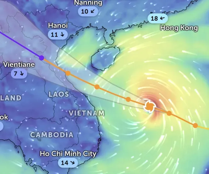
According to the National Center for Hydrometeorological Forecasting, strong winds are expected to directly affect coastal provinces in the northeastern region and north-central region, from Thanh Hoa to Hue. This is a very powerful storm, with wind intensity over land potentially matching or exceeding that of storm Kajiki, which made landfall in Ha Tinh earlier this year.
At noon on September 27, the Department of Meteorology and Hydrology under the Ministry of Agriculture and Environment reported that storm Bualoi continued rushing in a west-northwest direction at an average speed of approximately 35 kilometers per hour.
According to forecasts by the Japanese and Chinese meteorological agencies, the storm is expected to make landfall in Vietnam with wind speeds of level 12 (118 - 133 km/h), gusting to 15 (167 – 183 km/h). The Hong Kong Observatory (HKO) predicted the storm would be stronger, reaching level 13 with gusts of level 16. Meanwhile, the U.S. Navy forecasts the storm fury to be equivalent to level 12 on Vietnam's storm intensity scale.
Vietnam's National Center for Hydro-Meteorological Forecasting has warned that, starting from the afternoon of September 28, powerful winds will sweep across central provinces. Wind speeds in the area from Thanh Hoa to northern Quang Tri are expected to reach levels 8 (62–74 km/h) – 9 (75–88 km/h), with areas near the storm’s center experiencing gusts of level 10 (89–102 km/h) – 12 (118–133 km/h), and potentially up to level 14 (150–166 km/h). Meanwhile, provinces from Quang Ninh to Ninh Binh, as well as southern Quang Tri to Hue, may see winds at level 6 (39-49 km/h) – 7 (50–61 km/h), with gusts reaching levels 8–9.
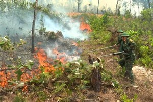
Between the night of September 27 and September 30, northern and north-central Vietnam are forecast to experience heavy to extremely heavy rainfall, with widespread accumulations of 200–400 millimeters, and localized areas possibly exceeding 600 millimeters. The risk of flash floods and landslides in mountainous regions is expected to be extremely high.