The Ministry of Agriculture and Environment is seeking public feedback on a draft circular introducing a national technical regulation on monitoring certain air quality parameters using remote sensing technology. The proposed framework aims to enable large-scale air quality monitoring using satellite data, reducing reliance on ground-based monitoring stations.
According to the draft, the remote sensing system will focus on six key pollutants, including CO, SO₂, NO₂, O₃, PM10 and PM2.5 (fine and ultrafine particulate matter).
The draft excludes total suspended particles (TSP) and other toxic pollutants covered under current regulations.
")
Officials noted that while Vietnam already has national standards for ambient air quality (QCVN 05:2023/BTNMT), these are primarily based on traditional monitoring methods. In contrast, remote sensing-based monitoring has yet to be governed by a dedicated regulatory framework, resulting in inconsistencies in data management and utilization.
The new draft introduces technical procedures for deriving air quality indicators from remote sensing data. In particular, concentrations of PM10 and PM2.5 would be calculated using parameters such as Aerosol Optical Depth (AOD).
The regulation is expected to take effect in 2027
")
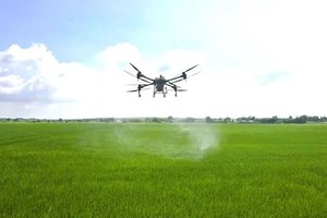
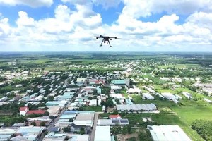
According to the Department of National Remote Sensing, a recent pilot project conducted between September and December 2025 in Hanoi used satellite imagery and UAVs to monitor air quality. The pilot identified more than 110 areas at risk of dust pollution.
The results also showed that combining satellite data with UAV technology allows for rapid identification of emission sources and large-scale mapping of polluted areas, supporting more effective environmental management and response.