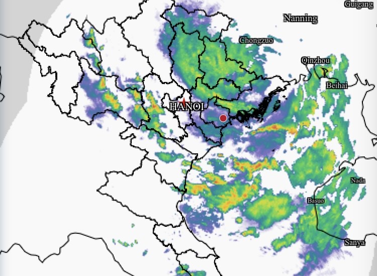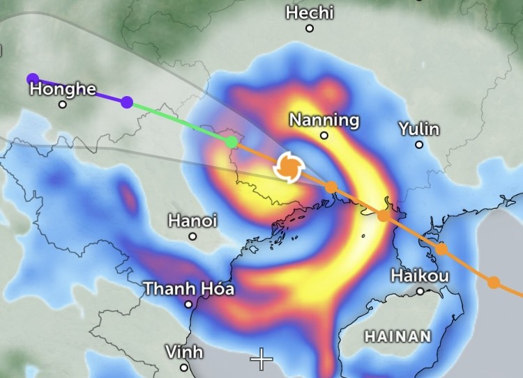
According to the National Center for Hydro-Meteorological Forecasting (NCHMF), at 6 a.m., the storm’s center was over Guangxi, with maximum sustained winds of 62–74 km/h, gusting up to 100 km/h. Strong winds were recorded around Bach Long Vi Island (level 8, gusting level 9), Co To Island (level 6, gusting level 8), and coastal areas of Quang Ninh–Hai Phong (gusting level 6–7).
In Hanoi, the weather remained calm this morning, with localized showers mainly in eastern wards and communes, such as Hoang Mai, Gia Lam, and Long Bien, while the western parts were still dry by 6 a.m. In Lang Son, however, heavy rain and strong winds began around 5:30 a.m.
The storm is expected to continue moving west-northwest at about 20 km/h and weaken into a low-pressure system over Northern Vietnam by late afternoon, with winds dropping below level 6. Quang Ninh, Lang Son, and the northern part of the Gulf of Tonkin will continue experiencing strong winds due to topographic interaction with the storm’s circulation.

From October 6 to the night of October 7, the storm’s remnants will bring heavy to very heavy rainfall across Northern mountainous and midland regions, totaling 100–200 millimeters and locally over 300 millimeters. The Northern delta and Thanh Hoa are forecast to receive 50–150 millimeters, with some areas exceeding 200 millimeters.
Hanoi is unlikely to face storm-level winds but may see thunderstorms, whirlwinds, and gusty conditions, with total rainfall reaching 50–100 millimeters and locally above 150 millimeters.


