The Ministry of Agriculture and Environment announced the information on August 5.
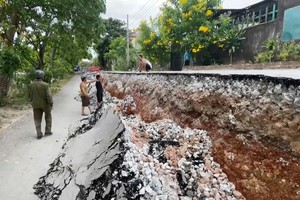
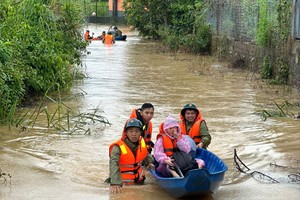
According to the ministry, landslides and flash floods have become increasingly severe due to climate change, particularly in the years 2020, 2023, 2024 and 2025, causing significant loss of life and property.
Despite the existence of various policies, gaps remain in legal frameworks, data systems, early warning capabilities and investment capital.
 on August 1 following flash flood")
Between 2018 and 2024, relevant authorities mapped high-risk zones in 22 provinces, developed a WebGIS-based early warning system, trained nearly two million individuals, implemented pilot warning infrastructure in Son La Province with JICA funding, and relocated nearly 22,000 households from high-risk areas.
For the 2025–2035 period, the proposed plan focuses on mitigating landslides and flash floods. During 2026–2030, authorities will produce comprehensive hazard maps for all mountainous areas and conduct detailed surveys of 1,500 high-risk sites.
From 2031 to 2035, efforts will continue with real-time warning systems, expanded monitoring stations, additional resettlement programs, structural protections for populations that cannot yet be relocated, community-based communication strategies, the planting of native forests, and the construction of sabo dams, anti-erosion embankments, and warning stations.
The total estimated budget for the plan is VND161 trillion (approximately US$6.1 billion). By 2030, the Government aims to complete all hazard maps and fully train disaster response teams.
By 2035, the plan seeks to modernize the warning network, automate 95 percent of monitoring stations, ensure all at-risk communities receive disaster preparedness education, and implement evacuation and alert strategies for all high-risk zones yet to be relocated.
The proposal also calls for the integration of artificial intelligence, big data, remote sensing, GIS and drone technologies. Key tasks include hazard zone classification, enhanced warning capacities, population resettlement, construction regulation enforcement, development of protective infrastructure, and the preservation and expansion of protective forests.

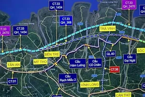
The plan will be implemented across 22 provinces and cities in the Northern mountainous and Central regions, including Dien Bien, Lai Chau, Son La, Lao Cai, Lang Son, Cao Bang, Tuyen Quang, Quang Ninh, Bac Ninh, Thai Nguyen, Phu Tho, Thanh Hoa, Nghe An, Ha Tinh, Quang Tri, Hue, Da Nang, Quang Ngai, Khanh Hoa, Lam Dong, Gia Lai and Dak Lak.