In late December 2025, reporters from Sai Gon Giai Phong conducted an on-site inspection of the 13-kilometer stretch—from the southern portal of Co Ma Tunnel to the interchange in Van Ninh Commune—and observed numerous damaged spots, concentrated mainly around kilometer markers 292 and 289.
Aerial views of this initial section (from km285 to km298) reveal extensive patchwork across the carriageway, with several areas suffering damage over relatively large surface areas. Residents living along both sides of the expressway said they had recently seen workers bringing in machinery to resurface sections with new asphalt.
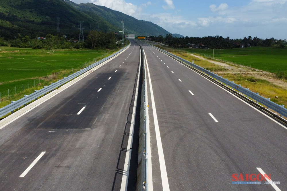

According to a representative of the Van Phong–Nha Trang Expressway Project Executive Board—under Project Management Unit 7 of the Ministry of Construction—the damage was caused primarily by the impact of heavy rains and flooding. Initially, the deterioration was limited in scale; however, the project management proactively expanded the scope of repairs to ensure smoothness, safety, and overall construction quality. To date, all damaged sections have been fully rectified.
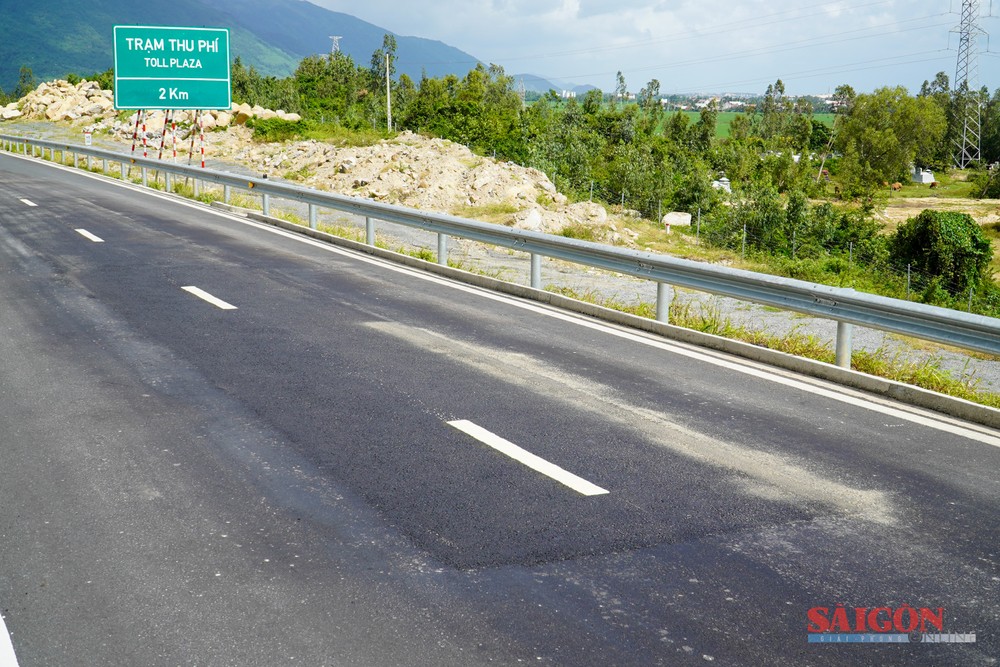


Although the project was largely completed in September 2025, this stretch has not yet been officially opened to traffic, as it is awaiting appraisal and approval by the relevant road management authorities. Traffic organization and regulation plans—particularly at the interchange near Co Ma Tunnel—must be carefully calculated to ensure absolute safety before the expressway becomes operational.
The Van Phong–Nha Trang Expressway project lies entirely within Khanh Hoa Province and is invested by Project Management Unit 7 under the Ministry of Construction, with a total investment of VND11.808 trillion. The route spans 83.35 kilometers, starting at the southern entrance of Co Ma Tunnel in Dai Lanh Commune near National Highway 1 and ending at its junction with the Nha Trang–Cam Lam Expressway. Of this total, 70.3 kilometers—from Van Ninh Commune to Dien Tho Commune—were completed and opened to traffic on April 19.


)