|
Bui Nguyen The Kiet is monitoring the status of Can Gio forest via his software in his office |
Approaching Can Gio District, many people can feel the fresh air and tranquil atmosphere seeing green trees after green trees along Rung Sac Street, which is stretching for tens of kilometers. This area houses Can Gio Mangrove Biosphere Reserve covering nearly 35,000ha – the green lung of HCMC.
Working in the area for around 18 years, Bui Nguyen The Kiet – Head of the Resource Management and Development Office of Can Gio Mangrove Forest Management Board – realized human power is never enough to manually calculate the forest area and manage it because these tasks are both time and labor consuming.
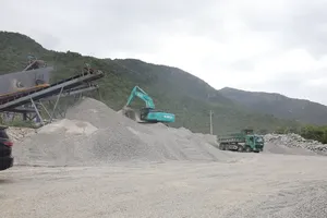
However, at present there are only 40 staff members in the Management Board to take care of such a large area of 35,000ha, along with the help of 126 assigned households and 11 patrol units. It is a mission impossible to monitor the forest and timely detect dead trees without reasons.
Therefore, Kiet wished to apply technology into the forest management task, leading to the birth of the initiative ‘Using Geographic Information System (GIS) in Resources Management in Can Gio International Mangrove Biosphere Reserve’.
He used various software pieces like MapInfo, Google Earth, Envi, and Locus Map to analyze and build up necessary databases as well as monitoring the forest status and the biodiversity conservation task right inside his office.
“Technology implementation has been extremely useful in forest management tasks. Since 2016, I’ve been able to detect more than 100ha of dead trees thanks to clear images and precise locations. This is helpful in proposing suitable methods for afforestation”, said Kiet.
He further explained that formerly, when in duty, patrol teams had to bring along professional equipment like GPS locators, which proved a grave threat to the machine owing to high humidity and saline water. Thanks to GIS application, all they need now is their own smartphone with the software installed to reach the exact destination quickly, even when the electromagnetic waves are rather weak.
With a few simple actions, Kiet can use the software to monitor the work of these teams right in his office, save their submitted data, and share any necessary information to them. This is absolutely time and cost saving while greatly boosting the overall performance.
The software was developed in a user-friendly way with clear instructions. Therefore, his initiative has been welcomed by many working groups, especially forest patrol teams and households in charge of protecting Can Gio forest. Thanks to the software, the mission of protecting natural resources in general and Can Gio Mangrove Ecosystem in particular can be fulfilled at ease.
Kiet forecast that in the future, the use of GIS in Vietnam will be more common in the forestry industry as more training sessions are held to improve professional skills for task forces.
One of the initiatives of Mr. Bui Nguyen The Kiet is the implementation of GIS in quantitatively checking the biodiversity and carbon volume in Can Gio Mangrove Forest. It has been certified by HCMC People’s Committee as an initiative with remarkable impacts in HCMC in 2019 (Decision No.1932/QD-UBND, issued on June 3, 2020). This initiative also won the third prize in the 4th HCMC Environment Awards on February 21, 2023.


)