A team of UNESCO assessors and cultural heritage experts is scheduled to travel to Lang Son to examine the geopark in July. The park is expected to open to the public to promote sustainable tourism development.
Currently, there are four routes visiting 38 tourist attractions in the geopark area.
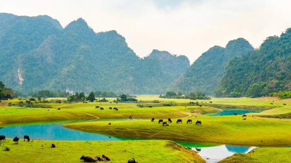
According to the Department of Culture, Sports, and Tourism of Lang Son province, Lang Son the geopark has mainly limestone mountain terrain and karst caves with many beautiful natural landscapes and historical heritage sites featuring the ancestors' accomplishments of the country.
Lang Son Geopark was established in 2021 and is located within the administrative boundaries of eight districts, including Bac Son, Chi Lang, Huu Lung, Loc Binh, Van Quang, Lang Son City, and parts of Binh Gia and Cao Loc districts. The geopark covers over 4,840 sq. km with a population of 627,000 people.


 Mountain on Chi Lang Pass")