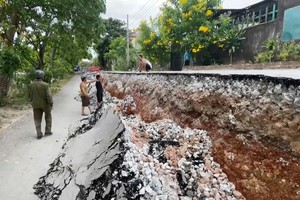
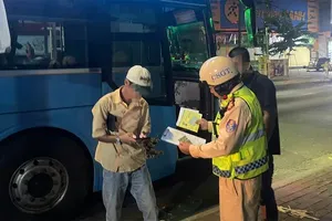
After three consecutive days of torrential downpours triggered by the circulation of storm No.5, the capital’s entire drainage system has been pushed to breaking point.
 is heavily flooded this morning, August 27.")

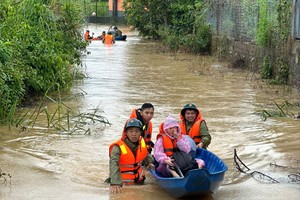
Automatic monitoring stations still recorded significant rainfall by 7 a.m. on August 27 — 127 millimeters in Dong Anh, 100 millimeters in Kim Anh, 100 millimeters in Trau Quy, and 74 millimeters in Soc Son, among other areas. Flooding continued to paralyze traffic on many streets, with several locations still heavily submerged, including Thang Long Boulevard, Hoai Duc Urban Area, the Xa La T-junction (Pham Tu), and National Highway No.32 through Tan Tay Do. These roads remained impassable to vehicles, while severe flooding at the Dam Quang Trung – Co Linh Intersection caused prolonged gridlock.

The persistence of inundation was attributed to regulating lakes in Hanoi having already reached full capacity, while drainage rivers such as the To Lich and the Nhue remained swollen from both urban runoff and upstream inflows. Rising levels in the Day and Tich rivers to the west and southwest of Hanoi have further slowed water discharge. When water levels in the Nhue River or the Day River exceed those in the inner city, sluice gates must be closed to prevent backflow, meaning floodwaters can only be pumped out through major stations such as Yen So, Dong Bong, and Co Nhue.

By late August 26, correspondents reported that floodwaters in the Day and Tich rivers had risen sharply, inundating pedestrian bridges in An Khanh and Hung Dao communes, while riverside areas faced heightened flood risks. The Department of Dyke Management and Disaster Prevention has since urged the Hanoi Department of Agriculture and Environment to urgently reinforce critical dyke sections, increase patrols, and promptly report any incidents for coordinated response.

The Northern Regional Hydrometeorological Center forecast that rain would continue across Northern provinces on August 27, with Hanoi seeing moderate to heavy showers, thunderstorms, and localized downpours, before conditions gradually eased later in the day. Authorities warned of possible tornadoes, lightning, and strong gusts during thunderstorms, while flood risks, flash floods, and landslides remain high.

One day earlier, on August 26, a representative of Hanoi Sewerage and Drainage One-Member Limited Liability Company confirmed that rainfall during the preceding 24 hours had far exceeded all forecasts, overwhelming the city’s drainage system and inundating dozens of locations across both inner and outer wards. Rainfall across Hanoi ranged from 200 to 300 millimeters, with several sites far surpassing the system’s design threshold: Hai Ba Trung Ward recorded more than 461 millimeters, Yen So 368 millimeters, Tay Mo 352 millimeters, Yen Nghia 334 millimeters, and O Cho Dua 323 millimeters.

Flooded areas on August 26 included Duong Dinh Nghe – Nam Trung Yen Street, My Dinh – Thien Hien Intersection, Hoa Bang Street (Alley 99), Vo Chi Cong Street (near UDIC Tower), Huynh Thuc Khang Street (Nguyen Hong junction – Alley 14), Alley 165 Thai Ha Street, Ngoc Lam Street, and To Huu Street (from Luong The Vinh to Trung Van). Particularly severe was deep flooding at underpasses No.1, No.5, and No.6 on Thang Long Boulevard.

To cope with the emergency, Hanoi Sewerage and Drainage Company had already activated a 24/7 emergency response, deploying its entire workforce of more than 2,000 staff across critical locations. All 20 pumps at Yen So Station were operating at maximum capacity, discharging about 90 cubic meters per second. Additional pumping stations, including Dong Bong 1, Dong Bong 2, and Co Nhue, together with major regulating lakes such as Bay Mau, Dong Da, Truc Bach, and Giang Vo, were fully opened to lower water levels. Hundreds of drainage inlets and outlets were also monitored round the clock, with workers clearing debris to accelerate water flow.


Despite these efforts, by late afternoon August 26, heavy rains continued to batter the city, with warnings of further flooding in peri-urban and border areas where drainage infrastructure remains incomplete. The situation has been further exacerbated by delays in the completion of the Yen Nghia pumping station project.