The Ho Chi Minh City People’s Committee has proposed that the Party Standing Committee of the municipal People’s Committee submit a report to the City Party Committee for consideration and approval of the principle allowing the municipal People’s Committee to organize, appraise, and approve the project according to the route plan proposed by the investor.
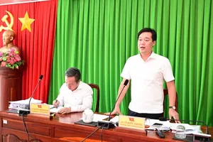
On the morning of November 19, the Office of the Ho Chi Minh City People’s Committee announced that Vice Chairman of the city Bui Xuan Cuong had signed Proposal No. 786/TTr-UBND, submitted to the Party Standing Committee of the municipal People’s Committee. The proposal seeks approval in principle for the Ben Thanh–Can Gio railway project, as proposed by Vinspeed High-Speed Railway Investment and Development Joint Stock Company.
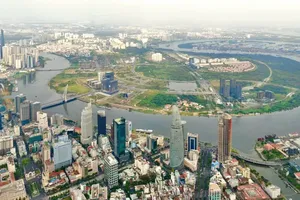
The Ho Chi Minh City People’s Committee has proposed that the Party Standing Committee of the municipal People’s Committee report to the City Party Committee for consideration and approval of the principle allowing the city to organize, appraise, and approve the project according to the route plan proposed by the investor. This plan will be incorporated into the amended Ho Chi Minh City Master Plan until 2040, with a vision to 2060, which was approved under Prime Ministerial Decision No. 1125/QD-TTg.
Previously, the route was proposed to begin in the area of Ham Nghi–Le Loi streets and Ben Thanh Market and pass through several central city streets. However, the Ho Chi Minh City Department of Culture and Sports has warned that the old route could pose risks to heritage structures such as Ben Thanh Market, the Hoa Xa complex (100-year-old Vietnam Railways Building) at 136 Ham Nghi Street, and the Fine Arts Museum on Pho Duc Chinh Street.
The Department has required the investor to ensure absolute safety and to take full responsibility for any tilting, cracking, or subsidence of heritage structures during construction.
To mitigate potential impacts, the investor has revised the route, shifting the starting point to September 23 Park and following Le Lai–Ky Con–Hoang Dieu–Doan Nhu Hai streets, passing through Nha Rong Port, reaching Tan Thuan 2 Bridge, and then connecting to Nguyen Van Linh Street.
The Ho Chi Minh City People’s Committee has requested prompt approval of the project principle to accelerate progress, while the detailed alignment will be assessed during the feasibility study phase. According to the project documents, the total land requirement is approximately 317.67 hectares.
The Ho Chi Minh City Department of Agriculture and Environment has confirmed the forest area involved and assessed the project as compliant with regulations on forest land conversion under Government Decrees 156/2018 and 91/2024.
Under Regulation 21-QC/TU (May 11, 2025), providing opinions on projects involving protected forests or projects covering 300 hectares or more falls under the authority of the Standing Committee of the City Party Committee and the Ho Chi Minh City Party Committee.
The Ho Chi Minh City People’s Committee emphasized that prompt approval of the project principle will provide a foundation to accelerate implementation, contribute to the development of the city’s strategic transport system, and promote socio-economic growth in the coming years.
The project will start at September 23 Park in Ben Thanh Ward and end at a 39-hectare site adjacent to the Can Gio sea reclamation tourist urban area project in Can Gio Commune. The route passes through the wards and communes, including Ben Thanh, Khanh Hoi, Xom Chieu, Tan Thuan, Tan My, Nha Be Commune, Binh Khanh, An Thoi Dong, and Can Gio.
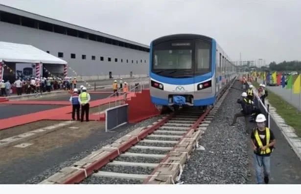
The project features a double-track railway with a standard gauge of 1,435 mm and electrification. The main line spans 52.92 km, with a design speed of up to 350 km/h. The first phase is expected to include two stations, including Ben Thanh and Can Gio. Phase two, to be developed as demand arises, will add four stations, consisting of Tan Thuan, Tan My, Nha Be, and Binh Khanh. A depot and an Operations Control Center (OCC) will be located in Can Gio Commune. The total land area required for the project is approximately 328.26 hectares, including the railway protection corridor.