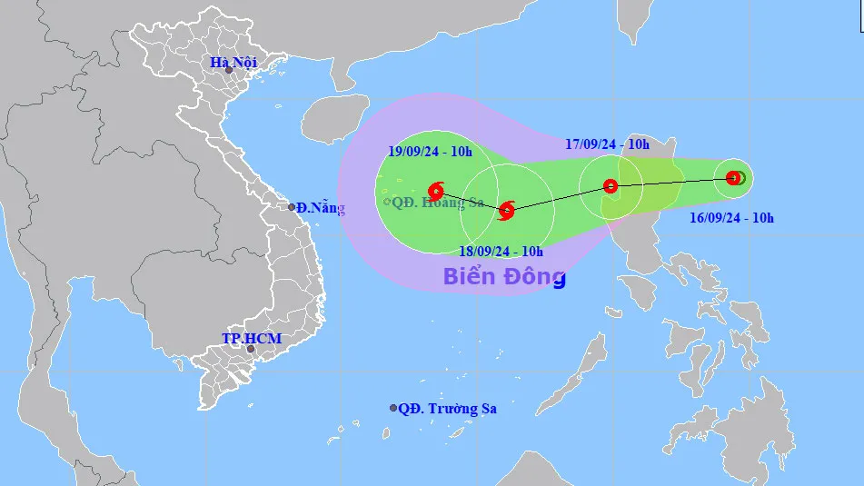
As of 10 a.m. on September 16, the center of the tropical depression was located at 17.1 degrees North latitude and 124.4 degrees East longitude, with wind speeds ranging from 39 to 61 km/h (levels 6-7) and gusts up to 75-88 km/h (level 9). The system is moving westward at a speed of 15 km/h.
In the next 24 to 48 hours, the tropical depression is expected to enter the East Sea. By 10 a.m. on September 17, it will likely approach the Western coast of Luzon Island, with wind speeds at level 7 and gusts at level 9.
By around 10 a.m. on September 18, the tropical depression is forecasted to intensify into a storm, located approximately 400 km East-Southeast of the Paracel Islands, with wind speeds rising to level 8 and gusts reaching level 10.
Over the next 48 to 72 hours, the storm may shift direction, moving West-Northwest at a speed of 10 to 15 km/h. From the morning of September 17, the Northeastern region of the East Sea is expected to experience strong winds at level 7, gusts at level 9, along with thunderstorms. Sea waves are forecasted to reach heights of 2 to 4 meters, causing rough conditions.


