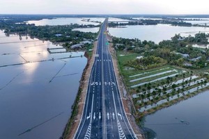
Widespread power outages, phone signal loss, and rising waters from the Cau River have plunged Thai Nguyen Province into crisis, with floodwaters submerging entire neighborhoods—some up to the second floor. Many residents spent the night stranded on rooftops, clinging to survival.
From the morning of October 7 through the early hours of October 8, torrential rain and severe flooding triggered by the remnants of typhoon No.11 (Matmo) inundated Thai Nguyen and several northern provinces, including Bac Ninh, Lang Son, Cao Bang, and Hanoi. Thousands of households were forced to evacuate as transportation networks were severed and entire residential areas turned into vast expanses of water.
Sleepless night as residents flee the floods
Thai Nguyen has become the epicenter of the current deluge. According to the Department of Meteorology and Hydrology under the Ministry of Agriculture and Environment, water levels on the Cau River at Gia Bay Station peaked at 29.9 meters at 1 a.m. on October 8, exceeding alarm level 3 by nearly three meters and surpassing the record flood of 2024 (caused by typhoon Yagi) by more than one meter.

Water flowing from the upper reaches of the Cau River began surging on the morning of October 7 and intensified overnight, submerging numerous residential zones downstream of Gia Bay Station and inundating parts of downtown Thai Nguyen. Many residents trapped by the fast-rising floodwaters late on October 7 desperately called for help on social media.

For 71-year-old Nguyen Thi Hung, who lives in Goc Voi 1 residential area, Linh Son Ward, it was a night of terror. “I spent 13 hours shivering on the rooftop—cold, hungry, and surrounded by water,” she said. Just a few hundred meters away, Tran Thi Hien and six relatives also took refuge on their roof, covering themselves with plastic sheets as floodwaters rose to the ceiling of their first floor.

Social media was flooded with pleas for help. Trinh Tham posted: “My parents are trapped inside. Their phones are dead, no way to reach them. Blue-roofed house, opposite the transformer in Goc Voi 1, Linh Son Ward, Thai Nguyen.” Another woman, An Nhu, wrote: “My parents are nearly 80. The water’s too high, food is gone, and it’s still rising. Please send help.”
Photos and videos circulating online showed entire neighborhoods under water. One viral clip from La Hien area (former Vo Nhai District) showed dozens of residents, including two toddlers aged one and two, stranded amid floodwaters. A trembling voice was heard in the video: “The water’s almost to the roof—we have small children, please help us!”
The Thai Nguyen Party Committee convened an emergency meeting on the evening of October 7. According to the committee’s standing body, three people have died, three remain missing, and many others are injured. At the Cha Dyke area, authorities evacuated 67 households from outside the embankment to safer ground. Out of 38 main roads, ten have been cut off, while numerous temporary bridges and drainage culverts were destroyed.
Hundreds of police officers, soldiers, militia members, and mobile police units under the Ministry of Public Security were mobilized overnight to support evacuation and rescue operations.
The National Center for Hydro-Meteorological Forecasting reported that floodwaters on the Cau River will recede slowly over the next 12–24 hours, though widespread inundation is expected to persist for another three to four days.
Rumors denied: No dam burst in Cao Bang
Flooding has also taken a toll across other Northern provinces. In Bac Ninh, water levels on the Thuong and Cau rivers simultaneously exceeded alarm level 3, with floodwaters spilling across roads in Phu Lang and Dong Cuu communes.
As of 3 a.m. on October 8, the Thuong River at Phu Lang Thuong surpassed the historic 1986 level of 7.52 meters. In Tien Luc Commune, a section of the auxiliary dike collapsed, flooding nearby fields; residents were safely evacuated.


In Cao Bang Province, local authorities dismissed social media rumors of a dam failure at a hydropower plant on October 7. Mr. Pham Xuan Tung, Director of the provincial Department of Industry and Trade, said he had inspected the scene and met with operators of Binh Long Hydropower Plant. “All reservoirs are safe and operating normally—there are no cracks, landslides, or leaks,” he confirmed.
The department attributed the sudden surge of the Bang Giang River to a “flood-crest resonance” phenomenon, caused by prolonged heavy rainfall combined with simultaneous discharge from upstream reservoirs.
To ensure safety, Mr. Le Hai Hoa, Chairman of the Cao Bang People’s Committee, personally inspected the affected areas and ordered hydropower plants—Binh Long, Bach Dang, and Thac Ban Gioc—to enhance monitoring and regulate discharge to relieve pressure on their dams. By late October 7, Bach Dang Hydropower Plant was releasing water through three spillways at a rate of 584 cubic meters per second, within technical limits.
Due to the threat of deep flooding downstream along the Bang Giang River, more than 250 households in Hoa An, Hung Dao, and Duc Long communes were evacuated to safer areas. By the morning of October 8, rainfall in Cao Bang had eased, and river levels were gradually receding.

Meanwhile, in Lang Son Province, the breach of the Bac Khe 1 Hydropower Dam in Tan Tien Commune on the afternoon of October 7 forced the evacuation of 23 households (101 people). No casualties were reported, though property losses were estimated at about VND50 billion (US$2 million).
According to Mr. Pham Duc Luan, Director of the Department of Dike Management and Disaster Prevention, a working team from the Ministry of Agriculture and Environment arrived at the scene shortly after. “Floodwaters remain high, flowing over the spillway and the damaged section of the dam. Residents downstream have been safely evacuated, and there are no fatalities,” he said.


From the night of October 7 through the morning of October 8, Hanoi continued to experience heavy rain and thunderstorms. The national forecasting center warned that flood levels across Northern rivers—including the Thai Binh, Thuong, and Cau rivers—will remain high through October 9. Light rain is expected to persist in Hanoi, Hai Phong, Quang Ninh, and several midland provinces this morning, before tapering off by the afternoon and ending completely on October 9.


)