The People’s Committee of Ho Chi Minh City has officially established a council to select architectural design for the Binh Tien Bridge and Road Project, a key transport infrastructure initiative improving connectivity between the city center and its southern area.
The council will comprise nine members and two secretaries. A chairperson will be elected from the members and will preside over all proceedings throughout the evaluation process.
The Binh Tien Bridge and Road Project will stretch approximately 3.66 kilometers, with a cross-section width ranging from 30 to 40 meters and a planned capacity of four to six traffic lanes. The route will begin at Pham Van Chi Street and end at the Nguyen Van Linh interchange in southern Ho Chi Minh City.
The project has a total investment of VND6,285 trillion (approximately US$238.3 million), fully funded by the state budget. Completion is scheduled for 2028.
The project is expected to create a new transportation axis, enhancing connectivity between the city center and the Saigon South New Urban Area, Hiep Phuoc Port, and Ring Roads 2, 3, and 4.
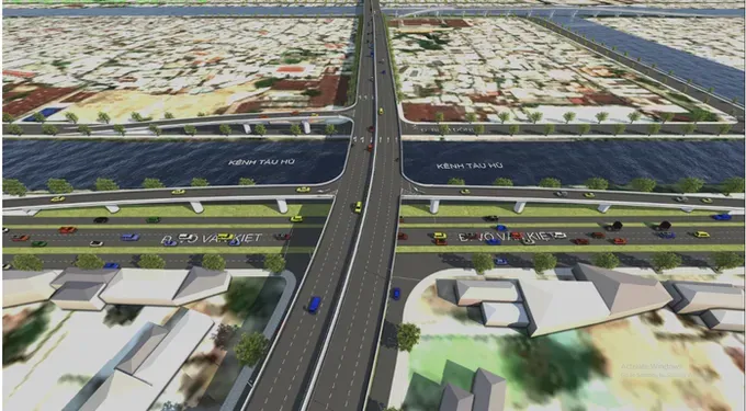
The city will launch an open, unrestricted design competition. Following a two-phase evaluation process, assessing both qualifications and design concepts, the selection council will score, rank, and submit the most optimal proposal to the Ho Chi Minh City People’s Committee for final approval. The winning entry will then be officially announced and awarded.
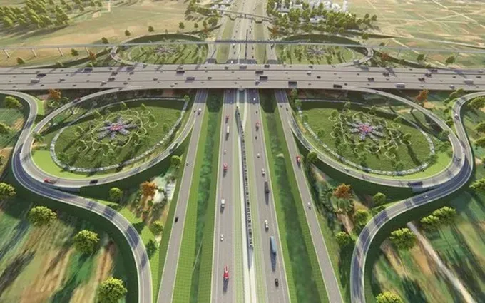
The Binh Tien Bridge and Road project represents the initial phase of a planned network of high-speed urban arterial roads currently under study by Ho Chi Minh City. Designed as a modern urban road, these roads will feature minimal intersections and may be constructed as elevated, underground, or hybrid routes to optimize traffic flow and land use efficiency.
Under its urban master plan, Ho Chi Minh City aims to develop around 10 high-speed arterial routes, including major projects such as the 43.4-kilometer North–South route 1, designed to ease congestion around Tan Son Nhat International Airport; the upgrade of National Highway 13 into a high-capacity corridor; a direct connection from Nguyen Huu Tho Street to Long Thanh International Airport; the 6.1-kilometer Northeast Arc; the 30.4-kilometer North–South Axis 2; and the 14.8-kilometer East–West Axis 1, among others.
Once completed, this network is expected to deliver a breakthrough in urban transportation, significantly enhancing regional connectivity and linking Ho Chi Minh City with emerging economic hubs across the southern region.

