Under the plan issued by the Hanoi Party Committee, the initiative aims to establish a transparent, two-way dialogue between local government and residents. Authorities seek to hear the concerns and aspirations of affected households while delivering swift, precise responses from regulatory bodies.
According to Plan No. 176/KH-SXD issued by the Hanoi Department of Construction on September 5, 2026, the consultation process will take place in two phases: during the drafting stage and during the appraisal stage.
The consultation covers 16 wards and communes directly within the planning boundary, including Thuong Cat, Dong Ngac, Phu Thuong, Hong Ha, Bo De, Long Bien, Linh Nam, O Dien, Me Linh, Thien Loc, Vinh Thanh, Dong Anh, Bat Trang, Thanh Tri, Nam Phu, and Hong Van, alongside 8 neighboring wards and communes within the zone of influence consisting of Tay Ho, Hoan Kiem, Cua Nam, Hai Ba Trung, Vinh Tuy, Vinh Hung, Yen So, and Yen Lang.
Relevant government bodies and local organizations in these jurisdictions have 15 days from the receipt of project documentation to submit their written feedback.
For directly affected local communities, planning documents and feedback forms will be publicly displayed at ward and commune People’s Committee headquarters or community centers. The materials, along with electronic feedback forms, will also be published on the official websites of the Hanoi Department of Construction, the Hanoi Urban Planning Institute, and local municipal portals.
To streamline public feedback, the Hanoi Department of Construction will host a series of hybrid town-hall meetings, combining in-person sessions at the Hanoi People’s Committee headquarters with virtual links to local venues, scheduled for September 11, 17, and 25.
During the formal appraisal phase, state management agencies must submit written comments within 10 days of receiving the dossier, while organizations and independent experts will have 15 days. Following this consultation period, the Department of Construction will convene the Appraisal Council in accordance with regulatory procedures.
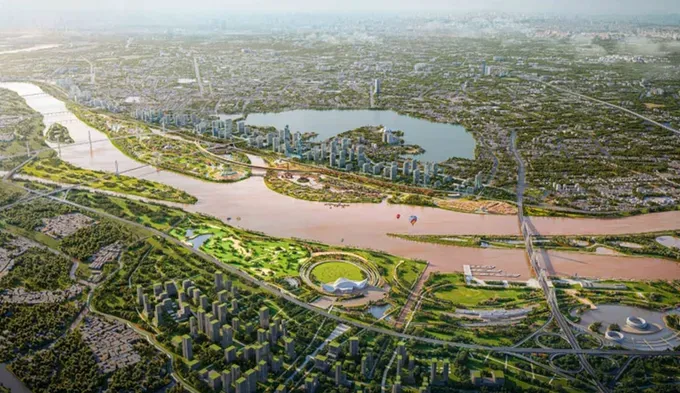
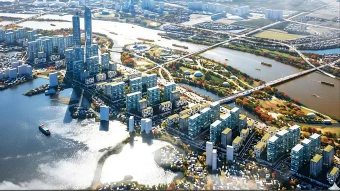
According to the Hanoi People's Committee, the scope of the Red River Urban Zone Master Plan adjustment spans approximately 40 kilometers along the river corridor, from Hong Ha Bridge to Me So Bridge, covering a total area of roughly 11,418 hectares across 16 wards and communes. The zone is currently home to more than 279,500 residents and contains 123 historical and cultural heritage sites. Agricultural land accounts for 50 percent of the area of 5,741 hectares, while residential land makes up 10 percent of the area of 1,102 hectares.
Under the proposed adjustment, the population of the entire area is expected to reach approximately 800,000 to 1.2 million people. The planned allocation of residential land is 55 square meters per person, while land for residential units is set at 15 square meters per person.
The projected building coverage ratio is 35 percent–40 percent for residential areas and 30 percent for service and public facilities.