This area frequently experiences induced earthquakes due to the impact of hydropower reservoirs.
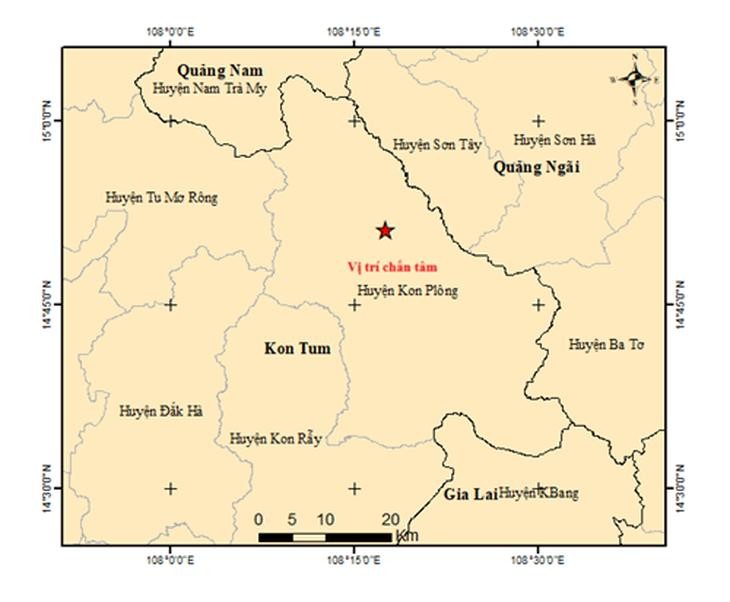
The first earthquake occurred at 4:08 a.m. with a magnitude of 3.1 on the Richter scale, at a latitude of 14.847 degrees North and a longitude of 108.282 degrees East, with a focal depth of approximately 8.1 km. This was also the strongest earthquake of the morning.
The second earthquake, with a magnitude of 3.0 on the Richter scale, occurred at 4:10 a.m. at a latitude of 14.849 degrees North and a longitude of 108.262 degrees East.
The third earthquake, with a magnitude of 2.6 on the Richter scale, occurred at 4:46 a.m. at a latitude of 14.852 degrees North and a longitude of 108.291 degrees East. Both of these earthquakes also had a focal depth of approximately 8.1 km.
The fourth earthquake occurred at 9:28 a.m. with a magnitude of 2.9 on the Richter scale.
The Institute of Earth Sciences has assessed that all four earthquakes have a disaster risk level of zero, meaning they are unlikely to cause damage. However, the research agency continues to monitor seismic activity in the area.