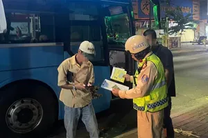
Residents have been warned of lightning, hail, whirlwinds, and strong gusts, with the disaster risk alert raised to level 1.
.")
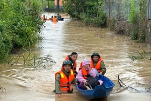
Water levels in river tributaries and canals have begun to rise across communes in the Dong Thap Muoi region, including Khanh Hung, Tan Hung, Vinh Hung, Moc Hoa, Tuyen Nhon, Hau Thanh, and Nhon Hoa Lap. Authorities forecast further flooding, which, in combination with tidal surges, could pose significant threats to flood-control dikes in Dong Thap Muoi and in upstream and midstream areas of the Mekong Delta with weaker embankments.
According to the provincial Department of Agriculture and Environment, many roads in the Dong Thap Muoi region double as embankments to facilitate both transportation and agricultural activities. In recent years, increasingly erratic weather patterns coupled with human impacts have sharply worsened erosion, subsidence, and flooding.
Tay Ninh currently has 33 flood-control embankments considered at risk during August and September, threatening more than 1,800 hectares of fruit crops. Of particular concern, one large embankment protecting over 4,000 hectares of rice fields is also in jeopardy should floods coincide with high tides.
Authorities urged residents to closely monitor rainfall and flooding developments, reinforce weak sections of embankments, regularly inspect dike systems, prepare pumping plans for prolonged rains, harvest rice at the appropriate time, and avoid planting in areas where flood-control systems are not secure.
Mr. Vo Minh Thanh, Director of the provincial Department of Agriculture and Environment, said Tay Ninh authorities were intensifying inspections, guidance, and support for residents in preventing inundation while also preparing for worsening drought, saltwater intrusion, and riverbank erosion. He stressed the need for proactive water resource management for both production and daily use during the dry season, and for agricultural scheduling in line with weather and water availability forecasts.
Tay Ninh has also proposed that the central government allocate nearly VND4 trillion to fund 11 embankment projects against river and canal erosion. The province further requested support for the development of an anti-drought and salinity intrusion system on the Vam Co River and the construction of the Thanh An freshwater reservoir.
On the same day, the People's Committee of Dong Thap Province issued a decision declaring an emergency due to riverbank erosion along the Tien River in the Thuong Phuoc area, near the Tien River anti-erosion embankment.
")
Chairman Tran Tri Quang instructed provincial agencies to immediately implement emergency measures to respond to and mitigate the damage caused by erosion. He also ordered continuous monitoring of subsidence, urgent stabilization of severely eroded sections and nearby areas, installation of warning signs, and cordoning off dangerous zones.
Relevant agencies were directed to consult experts and technical bodies for timely measures to prevent further erosion while awaiting long-term structural solutions. The public must be promptly informed through mass media about the erosion situation for proactive precautions. Land traffic through the affected zone was strictly prohibited.
Earlier, on August 7 and 12, four sections along the Thuong Thoi Tien embankment — nearly 2,800 meters in length — collapsed over a combined 350 meters, directly threatening disaster-prevention works, critical infrastructure, businesses, and local transportation.
The Thuong Thoi Tien embankment is part of the project “Management and Mitigation of Drought and Flood Risks in the Expanded Mekong Subregion,” spanning over 4 kilometers with total investment worth hundreds of billions of Vietnamese dong, completed in three phases from 2017 to 2019.